CRP Farm With Potential Home Sites, Hunting And Fishing Near Spickard
74.3± surveyed acres near Spickard, Missouri, with three stocked ponds, CRP income, installed electric, and potential home or cabin sites.
Property Snapshot
Grundy County CRP farm and pond tract
74.3± acres · Grundy County, Missouri · near Spickard
🟡 Conditional Candidate
A credible build-site and self-reliance candidate with strong water, access, and CRP-income advantages, but domestic water, septic, communications, and CRP restrictions still need verification.
Core Facts
- Price: $420,000
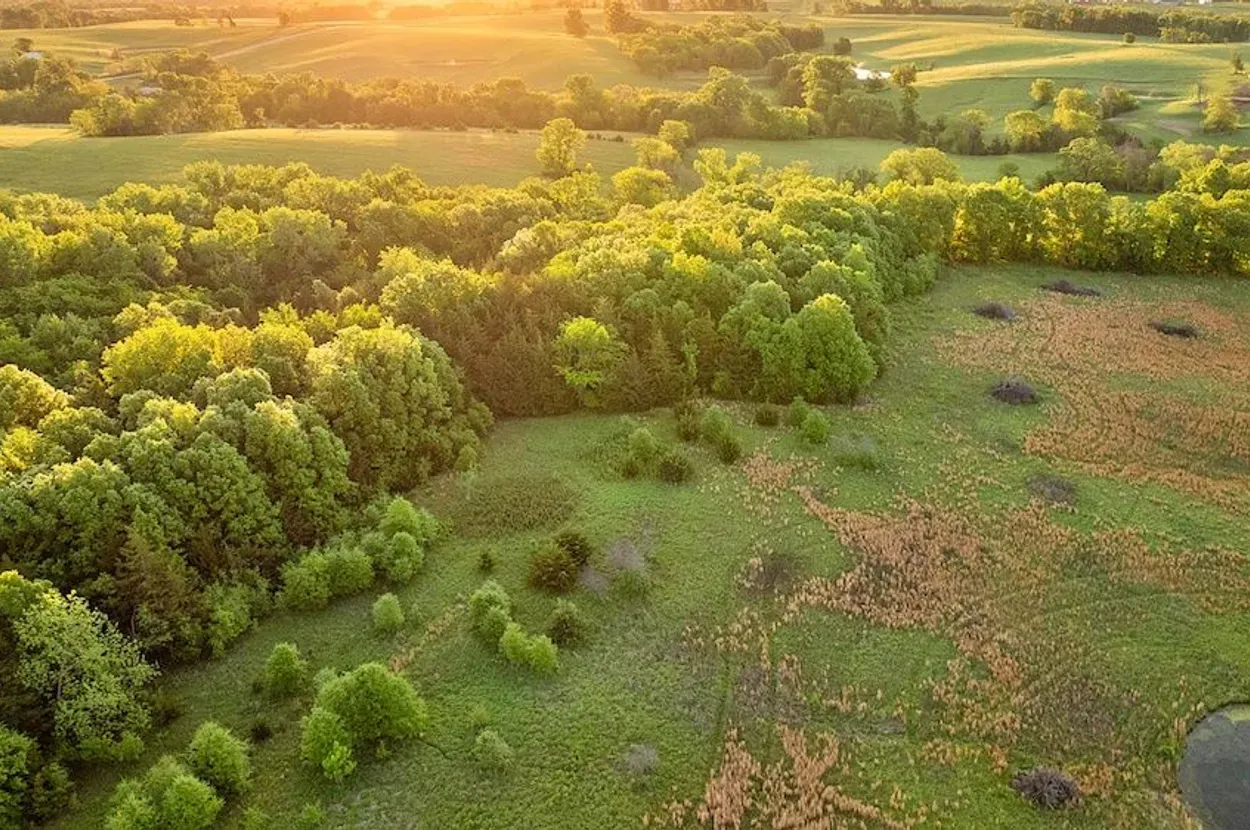
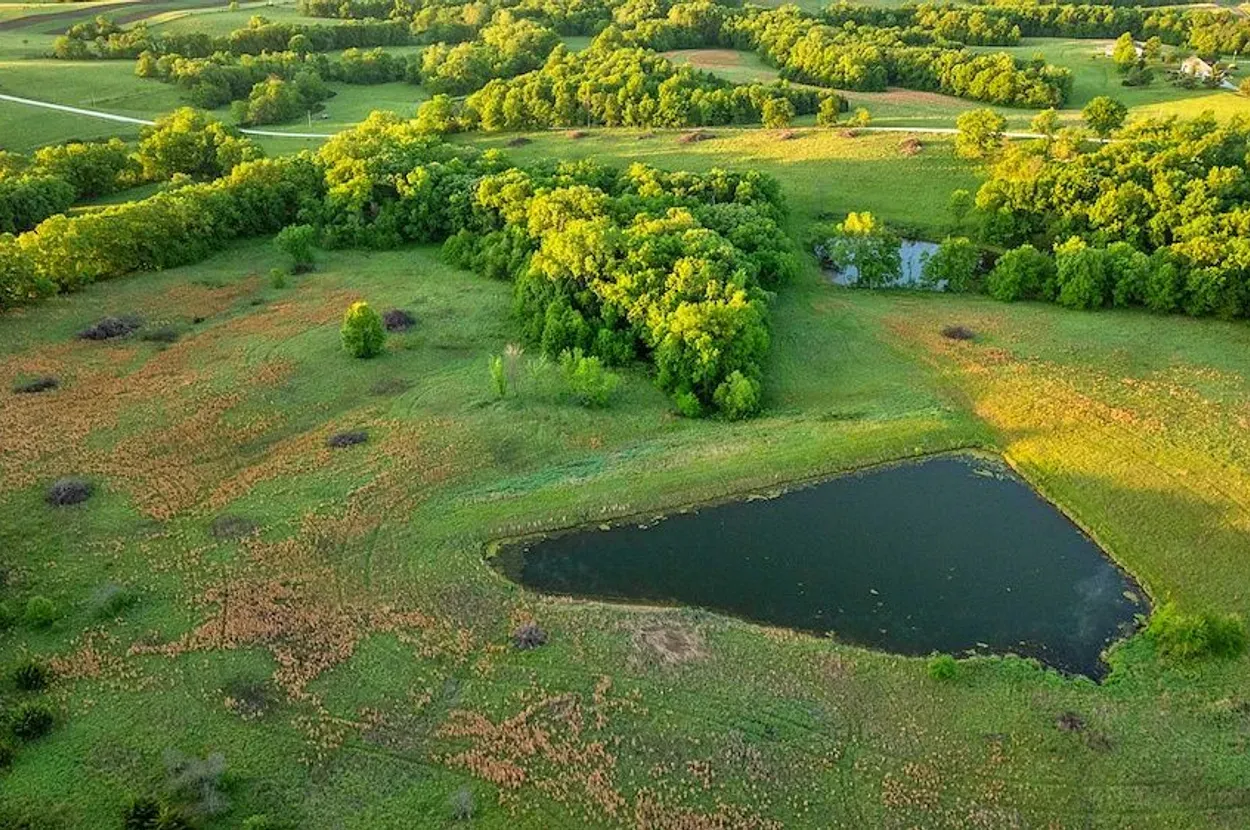
- Land: 74.3± surveyed acres with CRP ground, timber pockets, wildlife habitat, and three stocked ponds.
- Property type: Recreational land / undeveloped land with possible future residential use.
- Best fit: Rural homesite, weekend retreat, hunting/fishing base, or phased homestead buildout.
Resilience Read
- Water: Listing claims three stocked ponds; domestic water is listed as nearby, with a residential water meter reportedly approved.
- Infrastructure: Electric meter is reportedly installed; septic, driveway/building improvements, and water hookup are not confirmed.
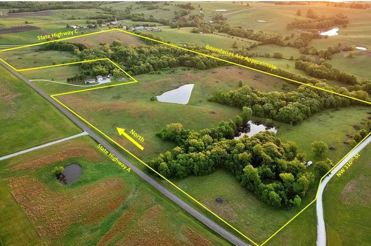
- Access: Listing claims frontage on three sides, including State Highway A and a county road.
- Use potential: CRP income, wildlife habitat, future homesites, and practical road access make this a flexible but due-diligence-heavy tract.
Source: Whitetail Properties
Reviewed: May 19, 2026 · Coordinates: 40.2413, -93.675
Property Media
Curated landscape images from the source listing. Images are used for review and attribution; buyers should verify current property condition in person.
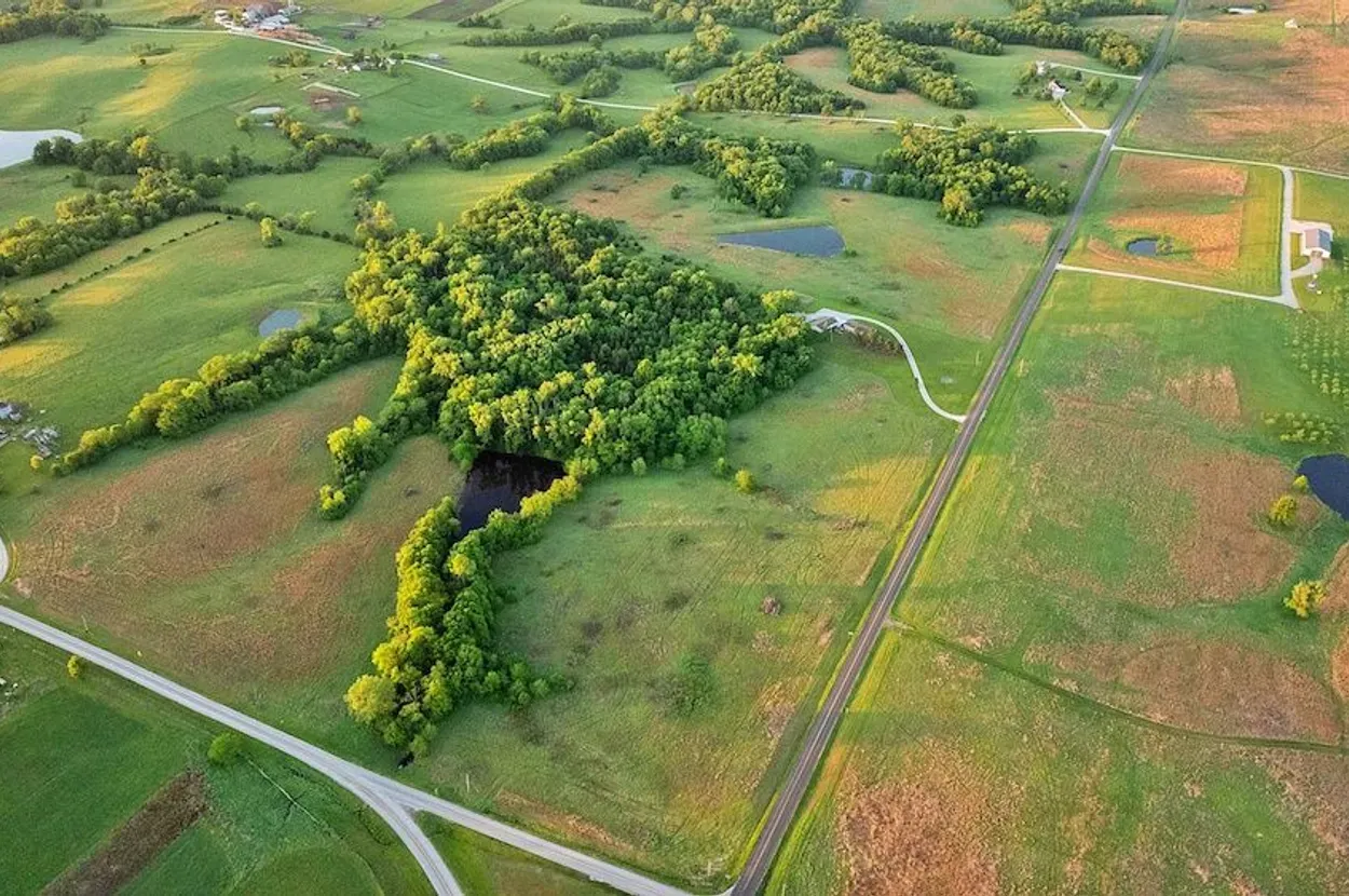

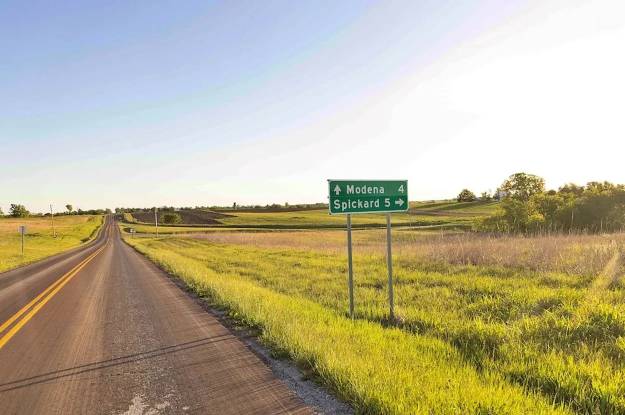
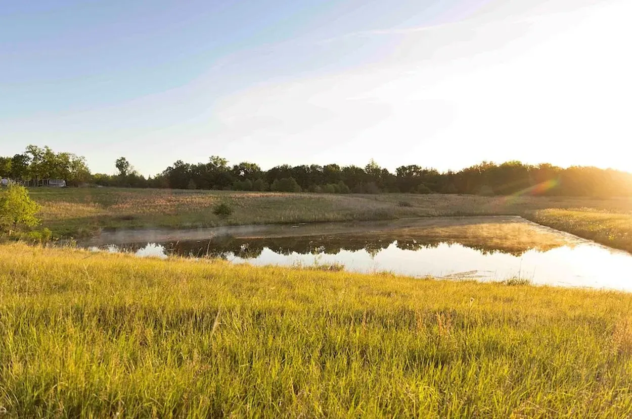
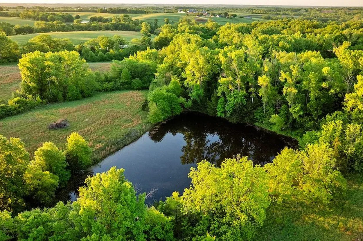
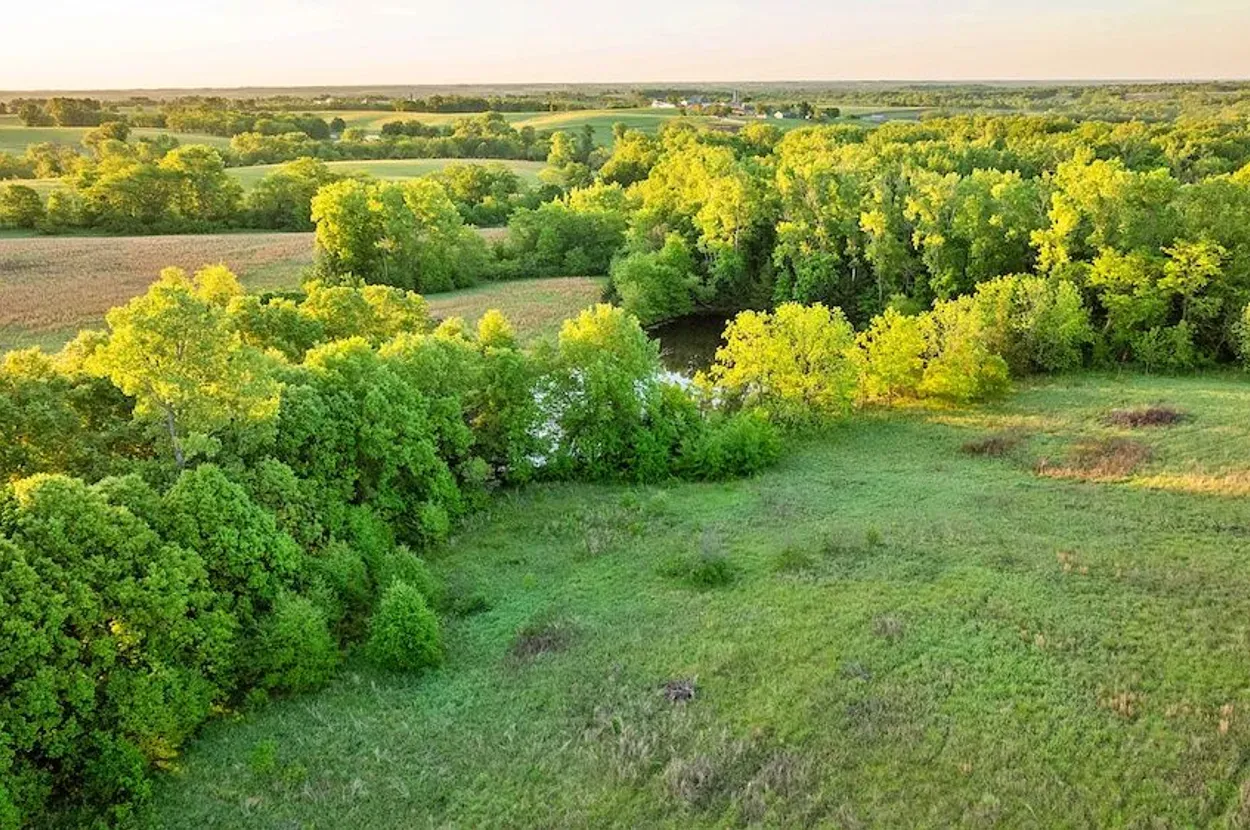
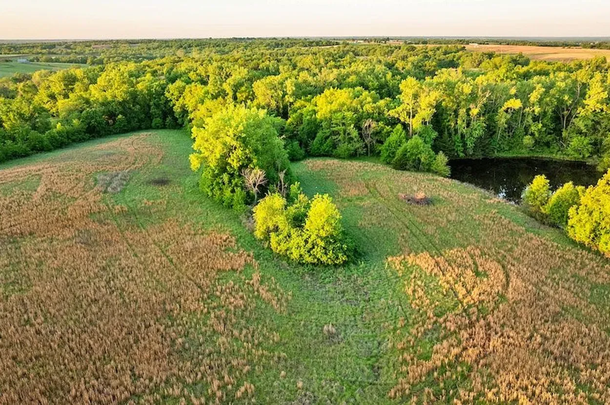
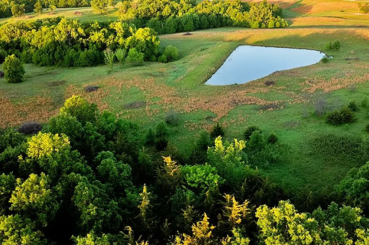
Source media: Whitetail Properties listing.
Executive Summary
This 74.3± acre Grundy County tract is one of the stronger undeveloped Whitetail candidates for a Resilience Atlas report because it combines build-site optionality, three stocked ponds, multiple road frontages, an installed electric meter, and a claimed residential water-meter approval. Those are meaningful early-stage advantages for a buyer who wants land that can move from recreation into a more resilient rural base over time.
The property is not turnkey. There is no finished home, confirmed septic system, confirmed internet, or independently verified domestic water service in the listing material reviewed. The CRP enrollment is also both a strength and a constraint: the listed $6,943 annual payment through 2032 is useful, but buyers need to verify assignability, allowed uses, maintenance duties, and how the contract affects homesite, driveway, food-production, and livestock plans.
The best case is a phased rural retreat: secure legal/utility details, choose a build location, confirm water and septic, keep the CRP income working, and use the ponds/timber/open ground for recreation and land stewardship. The worst case is a buyer assuming the listing’s “potential home sites” language means every practical/legal question is already solved.
Initial Verdict:
🟡 Conditional Candidate. Worth deeper due diligence because water, access, acreage, and income potential are unusually aligned for an undeveloped tract, but not a buy-before-verification property.
Key Strengths
- Three stocked ponds claimed by the listing, with bass, bluegill, and channel catfish.
- 42.15± acres reportedly enrolled in CRP with $6,943 annual income through 2032.
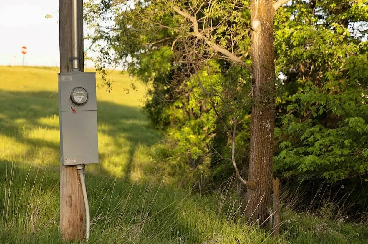
- Electric meter reportedly installed on the property.
- Residential water meter reportedly approved, though service details and costs need confirmation.
- Road frontage on three sides improves access, management, and build-site flexibility.
Key Concerns
- Domestic water is not confirmed as installed and operating; listing only states nearby/approved.
- No septic, perc test, or wastewater solution was verified from the listing.
- CRP rules may restrict disturbance, grazing, crop conversion, building placement, or timing.
- Internet and cell coverage are not confirmed in the listing.
- Multiple road frontages improve access but reduce deep-seclusion/privacy compared with a single-lane retreat parcel.
Location Analysis
Regional Context
The property is near Spickard in Grundy County, northern Missouri. The listing places it approximately 22.5 km / 14 miles north of Trenton and approximately 25.7 km / 16 miles south of Princeton. This puts it in a rural agricultural and recreational context with nearby small-town services, rather than deep remote isolation.
For Resilience Atlas purposes, that location is a practical middle ground: rural enough for land, ponds, hunting, and privacy, but not so far from towns that basic supply runs become unrealistic. Buyers should still verify actual drive times, winter road conditions, emergency response, and service availability.
Access and Roads
The listing claims frontage on three sides, with state highway frontage on the west and north boundaries and gravel county-road frontage on the south boundary. Road surfaces are listed as blacktop/asphalt and gravel. This is a strong access profile for future construction, equipment movement, emergency access, and property management.
The tradeoff is exposure. A parcel with frontage on three sides can be easier to reach and improve, but also more visible and porous than a landlocked-feeling private retreat. Gate placement, driveway design, screening, and posted boundaries would matter.
Distance to Services
Listing-provided distances are approximately 22.5 km / 14 miles to Trenton and 25.7 km / 16 miles to Princeton. Grocery, fuel, hardware, farm supply, medical, and emergency-service availability should be verified directly in those towns before purchase. The report did not independently verify specific providers or response times.
Land and Terrain
Acreage Usefulness
The 74.3± surveyed acres appear to offer a useful mix of open CRP ground, timbered habitat, pond edges, and possible homesite locations. That mix is valuable for wildlife, recreation, land stewardship, and phased development.
Because a large portion is enrolled in CRP, “usable acreage” does not automatically mean freely developable acreage. Buyers should treat the CRP contract as a core due-diligence document, not a footnote.
Soil and Growing Potential
The listing does not provide soil types, crop productivity ratings, perc-test results, or garden suitability. CRP enrollment suggests conservation-oriented open ground, but food production, orchard plans, livestock, and garden siting require USDA Web Soil Survey review and local soil testing.
Water Features
The listing claims three stocked ponds with bass, bluegill, and channel catfish. For resilience use, this is a major advantage for recreation, wildlife, and possible emergency water planning. It is not the same as verified potable water. Pond permanence, dam condition, water quality, liability, algae/contamination risk, and floodplain/wetland status should be confirmed.
Utilities and Infrastructure
Power
The listing states that an electric meter is installed onsite. That is a strong infrastructure signal for a future home, cabin, RV base, workshop, or well/water system. A buyer should confirm active service status, meter capacity, utility provider, upgrade costs, and exact distance from the meter to any preferred build site.
Water
Water is listed as nearby, and the description states the tract was recently approved for a residential water meter. That is promising, but not final. Confirm the utility provider, tap fee, meter-installation status, monthly minimums, line-extension requirements, freeze protection, pressure, and whether service can reach the desired homesite.
Septic and Waste
No septic system, perc test, lagoon approval, or wastewater plan was verified from the listing. This is one of the most important gating items before treating the property as a residential build candidate.
Internet and Communications
The listing does not confirm internet service. The rural setting may require cellular testing, fixed wireless checks, Starlink feasibility, or local provider confirmation. Buyers should test phones onsite and check FCC/provider maps before assuming remote-work viability.
Off-Grid and Resilience Potential
Solar Suitability
Open CRP areas may provide good solar exposure, subject to contract limitations and homesite placement. Ground-mount solar could be practical if allowed, but buyers should confirm CRP restrictions, county rules, utility interconnection, and tree/shade conditions.
Heating and Cooling
Future structures would need a four-season Missouri plan: efficient envelope, heat pump or propane/wood backup, storm resilience, and freeze-protected water lines. No existing dwelling or heating system is part of the listing facts reviewed.
Food Production Potential
Long-term food production may be possible, especially around future homesite areas, but CRP acreage is not automatically available for gardens, grazing, or row-crop use. Soil testing, CRP maps, water access, fencing, and local rules should drive any food-production plan.
Security and Privacy
The property has enough acreage, timber, and open ground to create privacy zones, but the three-sided road frontage makes boundary management important. This is better framed as practical access-plus-screening potential, not deep retreat seclusion.
Legal, Zoning, and Buildability
Zoning
Zoning and land-use rules were not independently verified in this pass. Confirm with Grundy County and any applicable planning/zoning authority whether residential construction, cabins, accessory buildings, RV use, livestock, ponds, wells, and multiple structures are allowed.
Permits and Restrictions
Key restrictions to verify include the CRP contract, survey and acreage, easements, driveway entrances, utility easements, pond/dam responsibilities, road frontage, wetlands/floodplain, and any recorded covenants. The listing itself includes a broker disclaimer that measurements, access, utility availability, acreage, and boundary lines are not independently verified.
Risk Assessment
Environmental Risks
Floodplain, wetlands, pond/dam condition, erosion, severe storms, drought effects on ponds, and soil limitations were not verified. Because the property has ponds and conservation acreage, environmental due diligence should come before final homesite selection.
Financial / Practical Cost Risks
The price is lower than turnkey rural residential properties, but the development costs are still real: water hookup, septic, driveway improvements, building pad, fencing, insurance, power upgrades, and communications may materially affect feasibility. CRP income helps, but should not be treated as guaranteed until contract documents are reviewed.
Practical Risks
The main practical risk is assuming the property is build-ready because it has an electric meter and water-meter approval. The buyer still needs legal buildability, septic feasibility, water service, driveway locations, CRP compatibility, and communications verification.
Estimated Development Path
Phase 1: Due Diligence
Confirm survey, boundaries, legal access, CRP contract terms, water-meter approval, electric service, septic/perc feasibility, zoning/building rules, floodplain/wetlands, soil suitability, pond condition, taxes, insurance, cellular coverage, and internet options.
Phase 2: Basic Use
After purchase and approvals, likely first steps would include driveway/gate planning, boundary marking, pond inspection, utility confirmations, campsite or temporary-base planning where legal, basic storage, wildlife/land management, and communications testing.
Phase 3: Resilient Buildout
A long-term path could include a modest home or cabin, solar-plus-battery backup, water storage, garden/orchard area outside CRP constraints, fencing, tool/storage building, pond management, and emergency communications.
Property Scorecard
Three stocked ponds are the central resilience strength; domestic water service is only listed as nearby/approved and still needs utility verification.
The acreage, timber pockets, and CRP fields create separation, but road frontage on three sides means visibility and access control require design.
Open CRP ground and future homesites suggest long-term productive use, but CRP rules, soils, and water access constrain immediate food production.
An electric meter is installed and a residential water meter is reportedly approved; septic, driveway, and building infrastructure remain unbuilt.
Open ground, road access, and pond water make solar/backup planning practical, though legal water/septic and winter resilience need confirmation.
The listing does not confirm internet or cell service; Starlink and FCC/provider checks should be part of due diligence.
Mixed open ground, ponds, and timber improve visibility and land management, but the property is not isolated from public roads.
Northern Missouri offers four-season rural usability, but drought, severe storms, pond reliability, and erosion need site-specific review.
Water, acreage, wildlife habitat, CRP income, and build-site potential give the tract a credible self-reliance path if utility and septic questions resolve.
The combination of stocked ponds, CRP income, multiple road frontages, and build-site optionality makes a strong Resilience Atlas case study.
It has the “start from land, water, and optionality” appeal many readers look for, though it lacks a finished home or barn.
State highway and county-road frontage are major advantages, but CRP rules, water-meter installation, septic, zoning, and survey details need verification.
80/120 · 🟡 Conditional Candidate. Strong enough to merit deeper due diligence, but still dependent on CRP, water-meter, septic, and communications verification.
Final Recommendation
🟡 Conditional Candidate
This property should move into deeper due diligence if the buyer wants an undeveloped rural base with water, access, and income potential. It is not turnkey, but it has enough fundamentals to justify serious review: acreage, ponds, electric, water-meter pathway, road frontage, and CRP income.
The decision point is verification. If CRP terms, septic feasibility, water service, and communications check out, the tract could become a very practical northern Missouri retreat or phased homestead site. If any of those fail, the property may still work as recreation/income land, but the residential resilience case becomes weaker.
Rating context: Candidate levels reflect how well the property fits Resilience Atlas criteria after weighing infrastructure, water, access, buildability, communications, risk, and unresolved due diligence.
Questions to Ask Before Moving Forward
- Can the listing agent provide the CRP contract, maps, payment history, and assignability terms?
- Is the residential water meter fully approved, paid, installed, or merely eligible?
- What is the tap fee and line-extension cost to the preferred homesite?
- Has a perc test or septic/site evaluation been completed?
- Are there any zoning, building, RV, tiny-home, cabin, livestock, pond, or agricultural-use restrictions?
- Are all three road frontages legal access points, and where are driveway entrances permitted?
- Are the ponds perennial, structurally sound, and outside problematic floodplain/wetland constraints?
- What internet options and cellular signal are available onsite?
- Are there easements, utility corridors, drainage rights, road-maintenance duties, or boundary disputes?
- What are the actual annual taxes after transfer and any reassessment?
Source and Verification Starting Points
- Source listing: Whitetail Properties — CRP Farm near Spickard.
- Map starting point: Coordinates 40.2413, -93.675.
- Floodplain starting point: FEMA Map Service Center coordinate search.
- Broadband starting point: FCC Broadband Map location summary.
- Soils starting point: USDA NRCS Web Soil Survey.
- County records starting point: Grundy County assessor/recorder, planning/zoning, road/driveway authority, and local health department for septic/perc requirements.
Listing facts are treated as unverified marketing claims until confirmed through county records, utility providers, CRP documentation, maps, and on-site inspection.