Serenity, Water And Wide Open Space Near Watkins Glen — Resilience Atlas Property Intelligence Report
31.7 acres / 12.8 hectares near Watkins Glen, New York, with Shequaga Creek, hay fields, paved state-highway frontage, and nearby electric.
Property Snapshot
Serenity, Water And Wide Open Space Near Watkins Glen
31.7 acres / 12.8 hectares · Schuyler County, New York · near Watkins Glen
🟡 Conditional Candidate · 70/120
This is a compelling creek-and-open-land candidate with strong access and Finger Lakes appeal, but it should move forward only after zoning, floodplain/wetland, septic, water, and utility-extension questions are resolved.
Core Facts
- Price: $175,000, per listing.
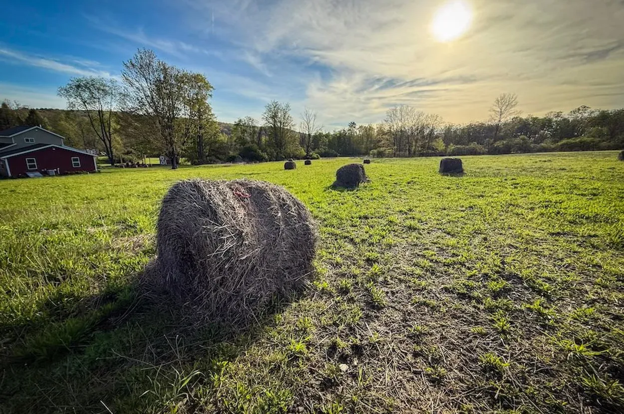
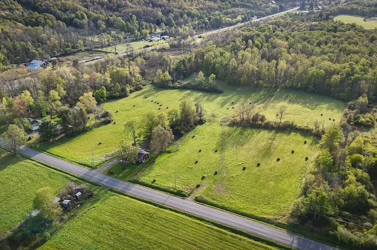
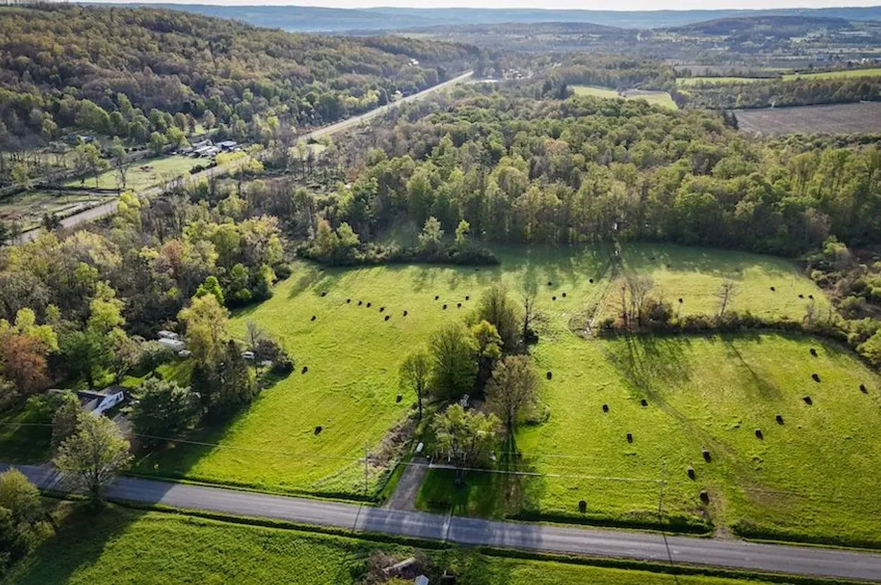
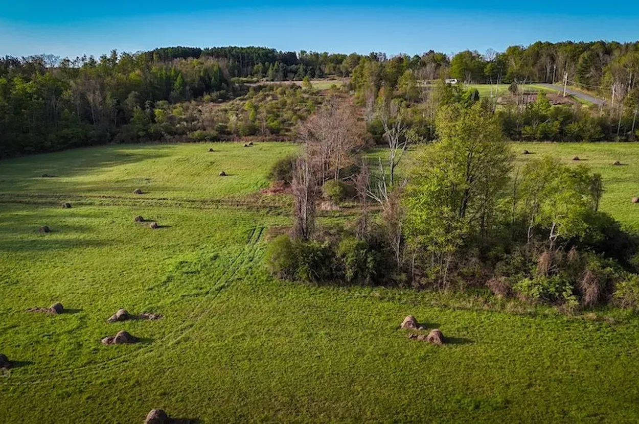
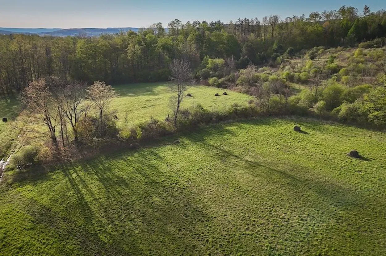
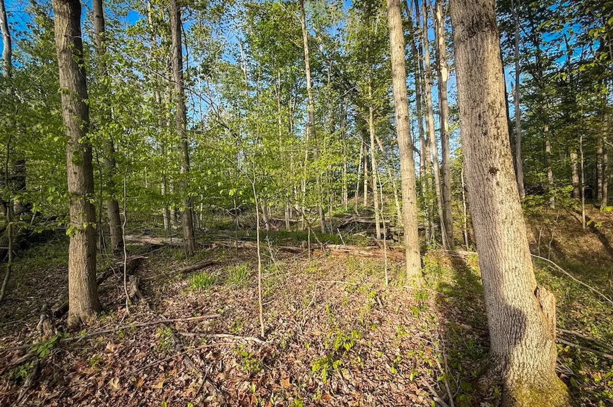
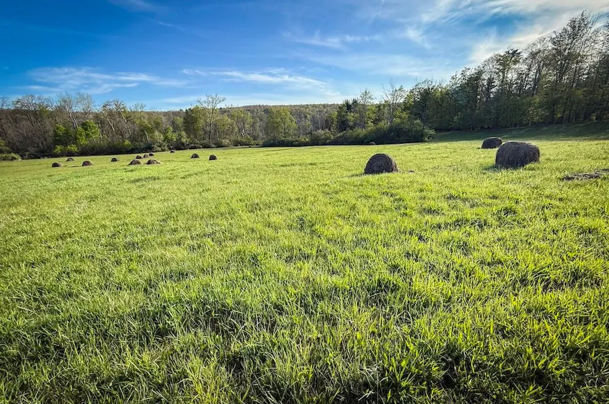
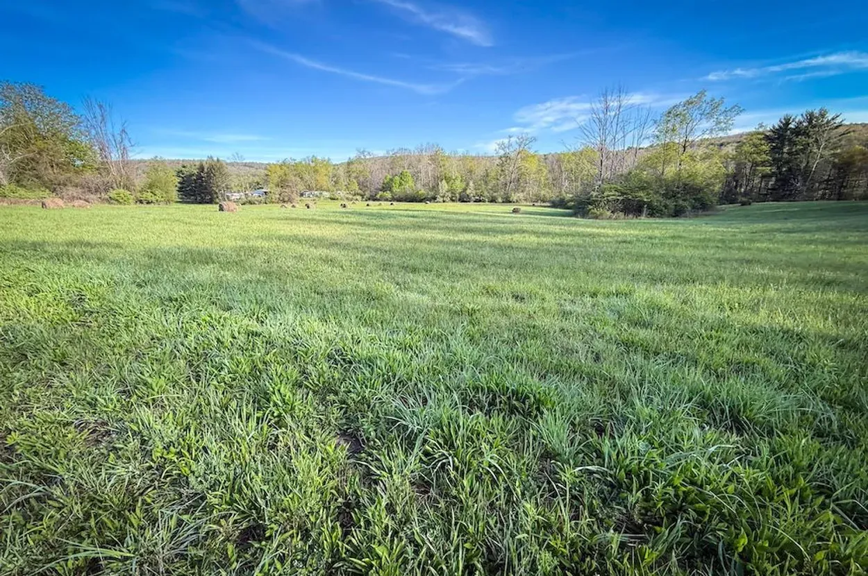
- Land: 31.7 acres / 12.8 hectares with a claimed 7+ to 7.5 acres / about 2.8 to 3.0 hectares of hay fields, wooded edges, and Shequaga Creek.
- Property type: Recreational land and residential land, per listing.
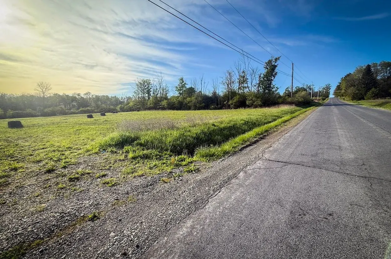
- Access: Paved state-highway frontage with four claimed entry points and about 390 m / 1,280 ft of road frontage.
- Utilities: Electric listed as nearby; well, septic, broadband, and utility-extension costs are not verified.
- Annual taxes: $1,947, per listing.
Resilience Read
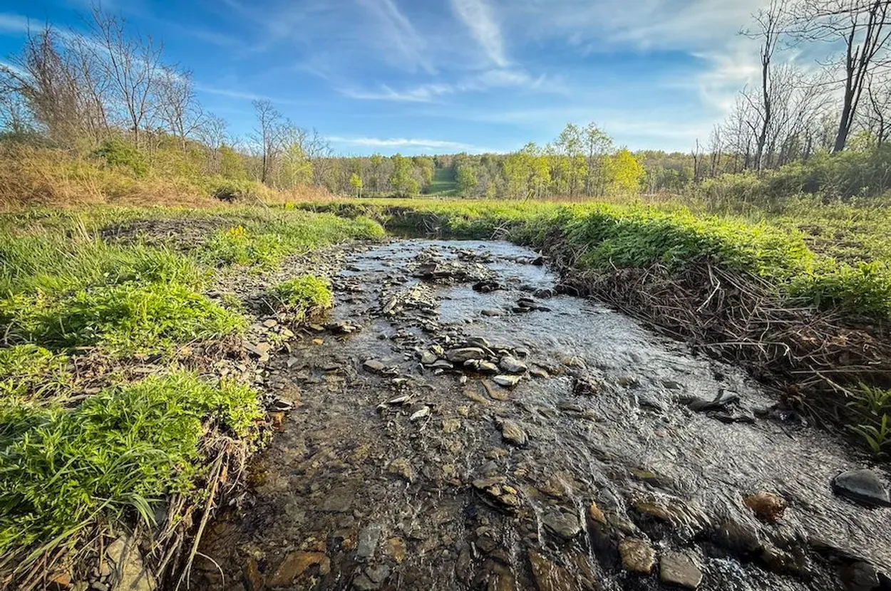
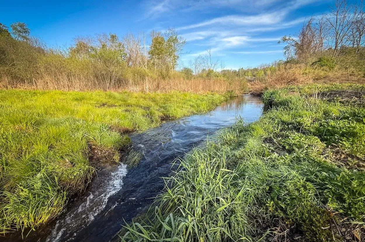
- Water: Creek presence is a major advantage, but it also triggers due diligence around setbacks, floodplain, wetlands, and erosion.
- Infrastructure: This appears to be raw land with nearby electric rather than a turnkey homestead.
- Access: Paved frontage and multiple access points are strong practical advantages.
- Use potential: Best suited for a carefully permitted home/cabin, homestead base, small food-production project, or recreational retreat if local rules cooperate.
Property Media
The media below uses the selected Whitetail property images uploaded to Ghost for stable review. The listing source remains Whitetail Properties.
Executive Summary
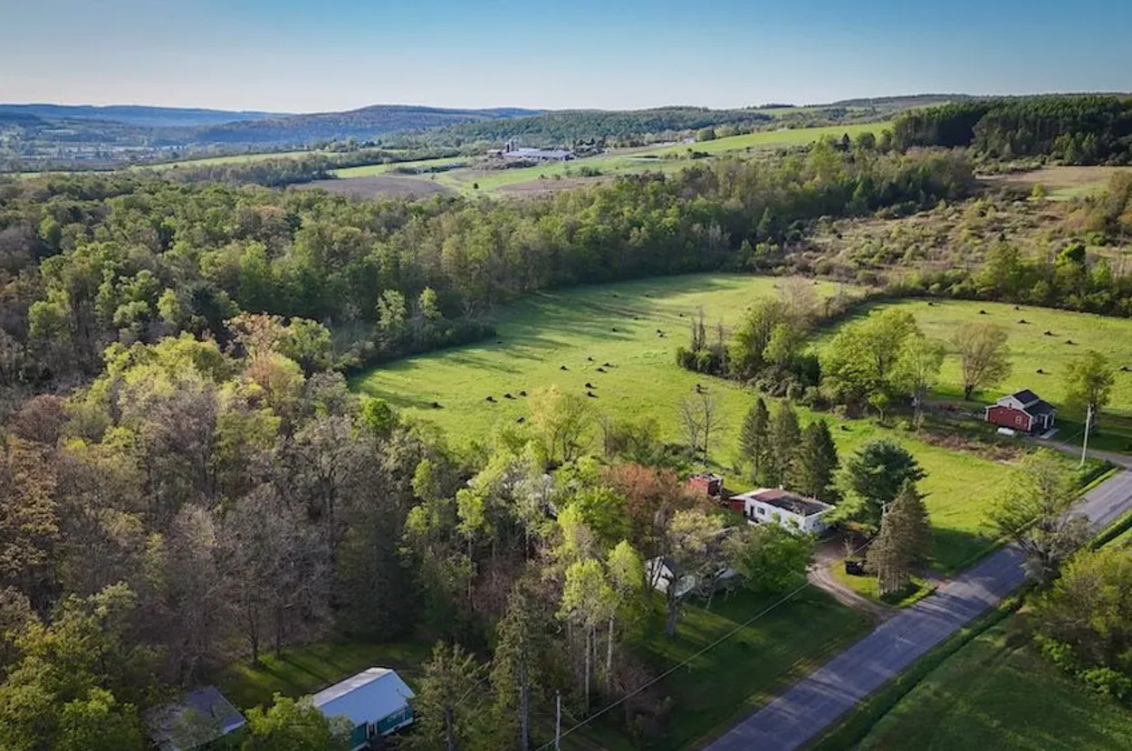
This Schuyler County property stands out because it combines usable open land, moving water, and very practical access in a recognizable Finger Lakes setting. The listing describes 31.7 acres / 12.8 hectares near Watkins Glen with Shequaga Creek running through the land, more than 7 acres / 2.8 hectares of hay fields, paved state-highway frontage, and nearby electric.
For Resilience Atlas, the strongest story is not luxury or speculation. It is a lower-price land base with creek character, open ground, and enough proximity to services to be more livable than a deep-remote retreat. The property is listed as about 16.1 km / 10 miles from Watkins Glen and area conveniences, and about 9.7 km / 6 miles from Watkins Glen International.
The caution is that creek properties can carry hidden constraints. Floodplain status, wetlands, stream buffers, septic feasibility, zoning, driveway approvals, and power-extension cost could materially change the buildout path. The listing’s marketing claims should be treated as leads, not verified facts.
Initial Verdict:
Worth deeper due diligence as a conditional creek-and-open-land homestead candidate, especially for a buyer who values access, water character, and Finger Lakes proximity over total seclusion.
Key Strengths
- Shequaga Creek provides a strong water and landscape story.
- Claimed 7+ acres / 2.8+ hectares of hay fields create practical food-production possibilities.
- Paved state-highway frontage improves access, construction logistics, and emergency reach.
- Four claimed road-frontage entry points may give layout flexibility if permitted.
- Nearby electric reduces one major infrastructure hurdle compared with deeper raw land.
- Watkins Glen and Finger Lakes context gives the property stronger reader appeal than an anonymous rural parcel.
Key Concerns
- Floodplain, wetlands, creek setbacks, and erosion risk are not verified.
- No well, septic, perc test, or potable-water solution was confirmed in the listing extract.
- Electric is nearby, not confirmed on-site; extension cost and easements need quotes.
- Zoning, residential buildability, camping/RV rules, tiny-home rules, and accessory-use limits need county/town confirmation.
- State-highway frontage improves access but may reduce privacy and can complicate driveway/entrance permitting.
Location Analysis
Regional Context
The property sits near Watkins Glen in Schuyler County, New York, within the Finger Lakes region. The listing emphasizes access to Watkins Glen State Park, Seneca Lake, regional wineries, breweries, marinas, hiking, fishing, boating, and year-round tourism.
That context matters for resilience use because it suggests a more service-connected rural property rather than a remote backcountry parcel. The tradeoff is less isolation and more road/tourism influence than a deeper rural tract.
Access and Roads
The listing identifies State Route 141 frontage, pavement, four road-frontage entry points, and more than 390 m / 1,280 ft of total frontage. Those are major positives for construction access, emergency access, and future driveway planning.
Before purchase, a buyer should confirm legal access, any DOT driveway permit requirements, sight-line standards, culvert requirements, and whether all four claimed entry points are usable or only theoretical.
Distance to Services
The listing places the property about 16.1 km / 10 miles or roughly 10 minutes from Watkins Glen and area conveniences such as grocery, restaurants, lodging, breweries, and other services. It also states the property is about 9.7 km / 6 miles or roughly 6 minutes from Watkins Glen International.
Hospital, urgent care, fire, EMS response, hardware, feed supply, and winter road-maintenance details were not independently verified for this report and should be checked before treating the site as a year-round base.
Land and Terrain
Acreage Usefulness
At 31.7 acres / 12.8 hectares, this is enough land for a private home site, gardens, orchard, small livestock, woodlot management, trails, and recreation without becoming a large-acreage management burden. The listing’s hay-field claim suggests a meaningful portion is already open and usable.
Soil and Growing Potential
The claimed hay fields are a positive food-production signal. They suggest at least part of the property has been open and managed rather than fully wooded or steep. Soil type, drainage class, depth to restrictive layers, slope, and wetness still need USDA Web Soil Survey review and on-site confirmation.
Water Features
Shequaga Creek is the defining feature. For resilience use, moving water can improve landscape value, wildlife, cooling, and general self-reliance planning, but it is not automatically potable water and should not be assumed usable for domestic supply.
Any buyer should verify floodplain mapping, stream setbacks, wetlands, bank stability, water quality, and whether the creek affects buildable envelope or septic placement.
Utilities and Infrastructure
Power
Electric is listed as nearby. That is better than no utility signal, but it is not the same as an installed meter. Confirm the serving utility, pole distance, easement path, transformer needs, and written extension estimate.
Water
No well or municipal water connection was verified in the listing extract. A buyer should confirm nearby water infrastructure, well-drilling feasibility, expected depth/yield in the area, water-quality risks, and whether creek proximity creates setback constraints for well placement.
Septic and Waste
No septic system or perc test was verified. Septic feasibility is a gating issue for any year-round residence. Confirm county health-department requirements, soil suitability, reserve area, creek setbacks, and whether seasonal high water table affects design.
Internet and Communications
Broadband and cellular service were not verified. The site’s proximity to Watkins Glen improves the odds of workable service, but an on-site phone test, FCC Broadband Map check, provider calls, and Starlink obstruction review are still needed.
Off-Grid and Resilience Potential
Solar Suitability
Open hay fields should create better solar options than a fully wooded tract. A ground-mount array may be practical if zoning, setbacks, topography, and snow/wind loading are addressed.
Heating and Cooling
A future build could combine grid power, solar backup, heat pump, propane, and wood heat depending on local rules and available woodlot management. The Finger Lakes climate requires real winter planning: snow access, freeze protection, backup heat, and reliable communications.
Food Production Potential
The claimed hay acreage supports a credible garden, orchard, poultry, or small-livestock plan. Irrigation should not be assumed from the creek without legal and environmental review. Soil testing, fencing, deer pressure, and drainage checks are needed.
Security and Privacy
The property appears more service-connected than deeply secluded. Multiple entry points and highway frontage are excellent for access but less ideal for privacy. A good site plan would use distance, vegetation, creek corridors, and driveway design to create a quieter interior zone without overstating security claims.
Legal, Zoning, and Buildability
Zoning
Zoning was not verified. Confirm permitted residential use, agricultural use, accessory buildings, RV/camping duration, tiny homes, manufactured homes, short-term rentals, multiple dwellings, livestock rules, and any local watershed or stream-corridor overlays.
Permits and Restrictions
Confirm survey, legal description, road frontage, driveway permits, easements, mineral/timber rights, deed restrictions, wetlands, floodplain, stream buffers, and any conservation or agricultural-program obligations. The Whitetail listing disclaimer specifically notes that access, utilities, measurements, acreage, and mapping boundaries are not independently verified by the broker.
Risk Assessment
Environmental Risks
The main environmental due-diligence issues are creek flooding, bank erosion, wetlands, seasonal wet soils, winter snow/ice, and drainage around potential build sites. None of these are deal-breakers by themselves, but they can sharply limit where a home, septic field, driveway, or barn can go.
Financial / Practical Cost Risks
The property’s listed price is accessible compared with many improved Finger Lakes properties, but raw-land costs can compound quickly. The largest practical risks are electric extension, driveway work, well drilling, septic design, survey, permits, site clearing, and potential flood/wetland constraints.
Practical Risks
The parcel may be not remote enough for a buyer seeking deep privacy, and not turnkey enough for a buyer seeking immediate homestead use. Its value depends heavily on whether due diligence confirms a clean buildable area outside constrained creek corridors.
Estimated Development Path
Phase 1: Due Diligence
Confirm zoning, legal access, DOT driveway permissions, survey, creek setbacks, FEMA floodplain, wetlands, soil/perc, well feasibility, utility-extension costs, broadband/cell service, taxes, insurance, and any deed restrictions.
Phase 2: Basic Use
After closing and permitting, likely first steps would include access planning, a marked driveway or improved entrance, boundary marking, soil testing, basic mowing/field management, a utility quote, a well/septic feasibility package, and temporary storage only if local rules allow.
Phase 3: Resilient Buildout
A long-term buildout could include a modest home or cabin, solar plus batteries, backup generator, garden, orchard, poultry, rainwater catchment for non-potable uses where legal, woodlot management, improved communications, and careful creek-buffer stewardship.
Property Scorecard
Shequaga Creek is a meaningful surface-water feature, but floodplain, setbacks, water rights, and potable-water options still need verification.
The parcel has fields, woods, and creek character, but paved state-highway frontage and four entry points reduce seclusion.
The listing claims more than 7 acres / 2.8 hectares of hay ground, giving it practical garden, small livestock, or orchard potential if soils and drainage check out.
Electric is listed as nearby, not installed; no well, septic, driveway, structures, or utility-cost details were verified.
Open fields improve solar potential and creek terrain adds usefulness, but legal buildability, water, waste, and winter access must be confirmed.
The location near Watkins Glen improves the odds of cellular or wired service, but FCC/provider and on-site signal checks remain unresolved.
Road frontage and multiple entries improve access but limit natural privacy; creek corridors and wooded edges provide some screening.
Finger Lakes climate, water presence, and usable open land are positives, balanced by possible creek flooding, snow/ice, and drainage unknowns.
A modest-acreage homestead, garden, orchard, small livestock, and solar buildout look plausible if zoning, septic, and floodplain constraints cooperate.
Creek, hay fields, open space, and Watkins Glen/Finger Lakes context give the property a clear reader hook.
The combination of moving water, meadow, and a recognizable regional destination is visually and emotionally strong.
Paved state-highway frontage and four claimed entry points are strong, but zoning, survey, setbacks, wetlands, and utility extension costs remain key unknowns.
70/120 · 🟡 Conditional Candidate
Rating: 🟡 Conditional Candidate — viable only if key unknowns resolve.
Final Recommendation
🟡 Conditional Candidate
This property deserves deeper due diligence because it has the right Resilience Atlas ingredients: water, open land, access, nearby power, usable acreage, and a strong Finger Lakes story. It is not a turnkey homestead, but it could become a practical small retreat or resilient living base if the buildability questions check out.
The decision should hinge on the creek constraints. If floodplain, wetlands, septic, and driveway approvals leave a clean build envelope, the property becomes meaningfully stronger. If those issues compress the usable area or make septic/power expensive, it should remain a watchlist property rather than a priority acquisition.
Rating context: Candidate levels reflect how well the property fits Resilience Atlas criteria after weighing infrastructure, water, access, buildability, communications, risk, and unresolved due diligence.
Questions to Ask Before Moving Forward
- Is legal access confirmed for the intended entrance?
- What zoning applies, and what uses are permitted by right?
- Are RVs, cabins, tiny homes, manufactured homes, livestock, and accessory buildings allowed?
- Is there a current survey showing all boundaries, frontage, creek location, and easements?
- Is any part of the property in FEMA floodplain or mapped wetland?
- What stream setbacks apply to Shequaga Creek?
- Has a perc test been completed, and where would the septic reserve area go?
- What would a well likely cost, and what are typical yields/water-quality issues nearby?
- Which utility serves the road, and what is the written cost to set a meter?
- What wired broadband, fixed wireless, cellular, and Starlink options work at the actual build site?
- Are there deed restrictions, covenants, agricultural obligations, or conservation limits?
- What are the full annual taxes and insurance constraints for a future dwelling?
Source and Verification Starting Points
- Whitetail Properties source listing — listing facts, photos, broker description, coordinates, and broker disclaimer.
- Map coordinate check — starting point only; parcel boundaries must be confirmed through official records or survey.
- FEMA Flood Map Service Center search — verify floodplain status near Shequaga Creek.
- FCC Broadband Map location search — verify fixed broadband claims and providers.
- USDA Web Soil Survey — verify soils, drainage, farmland classification, and septic/growing constraints.
- Schuyler County/Town planning, assessor, and GIS offices — verify zoning, tax parcel, setbacks, road frontage, permits, and building rules.