Large-acreage northern Wisconsin timberland near the Lake Superior South Shore, with strong privacy and habitat value but important water, wetland, and buildability questions still to verify.
Property Snapshot
Lake Superior South Shore Wildland
275.68± acres · Douglas County, Wisconsin · near Superior, WI
🟡 Conditional Candidate
A compelling large-acreage Northwoods candidate with strong privacy, habitat, internal access, and a cleared build-location signal — best pursued only after confirming water, wetlands, zoning/buildability, winter access, and utility-extension costs.
Core Facts
- Price: $379,000, according to the listing.
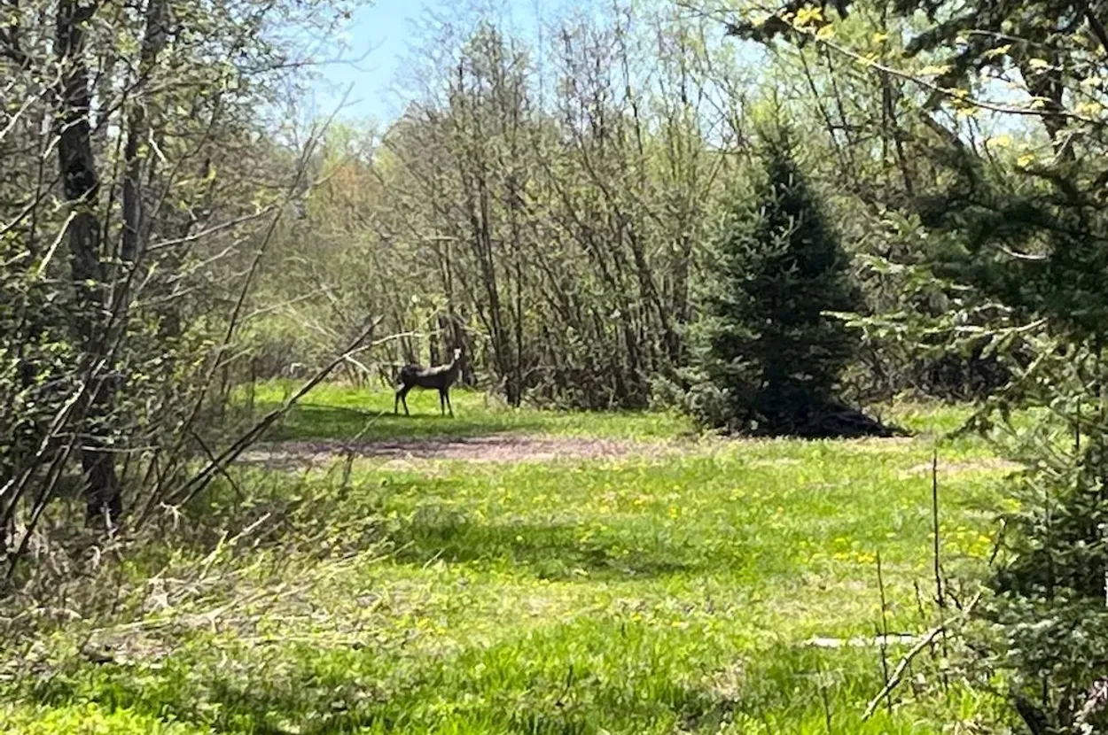
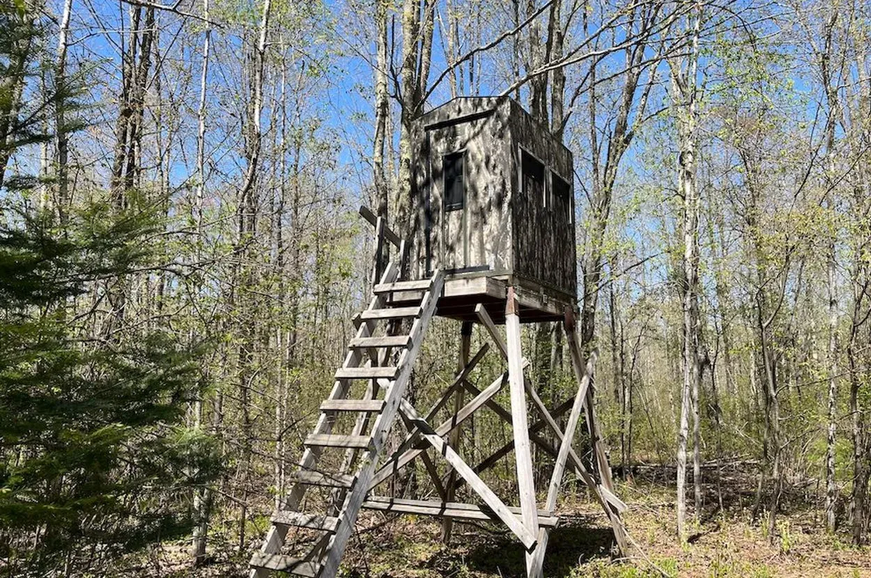
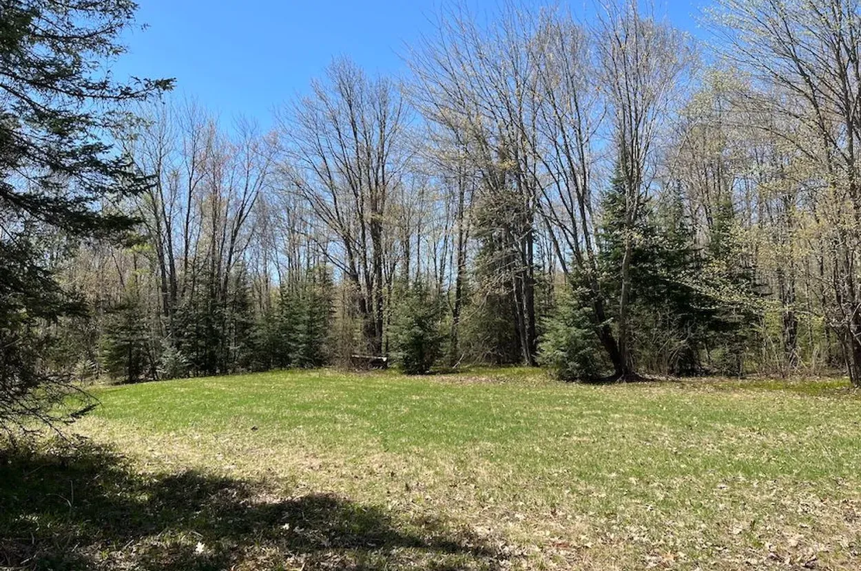
- Land: 275.68± acres with mature and regenerating timber, pasture/tillable signals, food plots, trails, blinds, and mixed high/low cover.
- Property type: Farms, ranches, and hunting land, according to Whitetail Properties.
- Best fit: Northern Wisconsin cabin/hunting base, privacy retreat, long-term timberland/homestead prospect, or low-density resilient landholding.
Resilience Read
- Water: Creek/spring and nearby water are listing claims; potable supply, seasonality, wetland constraints, and legal usability still need due diligence.
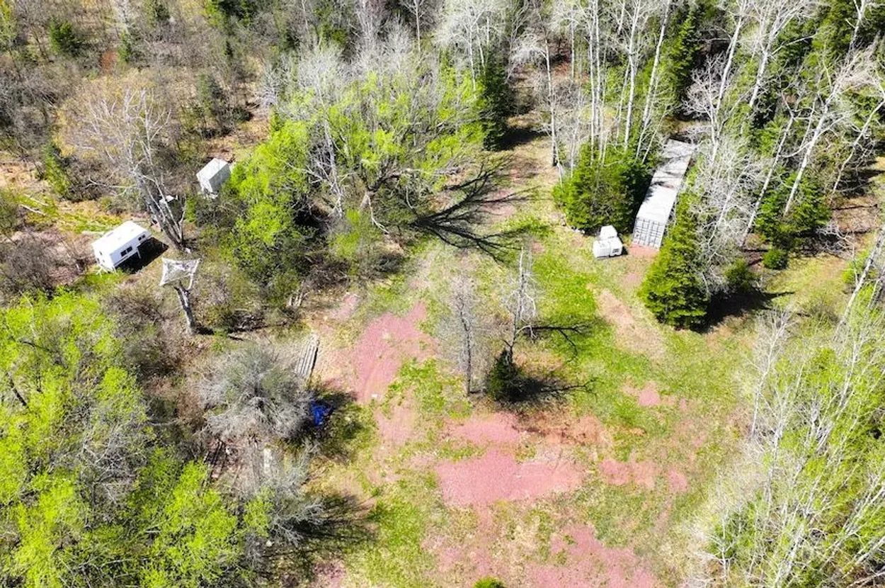
- Infrastructure: Township gravel road frontage, internal trail/road system, established food plots/blinds, and a cleared building location are positives; no house, well, septic, or active utility service is listed.
- Access: Listing references Brannan Road access and township road frontage; winter maintenance, driveway condition, emergency response time, and legal access should be verified.
- Use potential: Strong privacy, hunting, woodlot, cabin, and off-grid-retreat potential, with food production limited by climate, soil, drainage, and water unknowns.
Source: Whitetail Properties
Reviewed: 2026-05-19 · Coordinates: 46.5278, -91.9114
Property Media
Curated from Whitetail Properties listing media; selected for landscape orientation, land context, and reader usefulness.
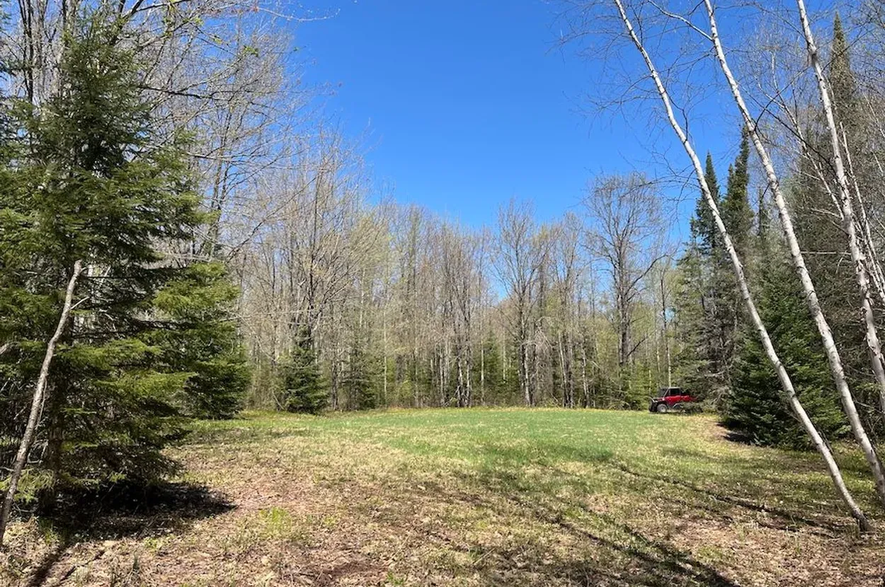
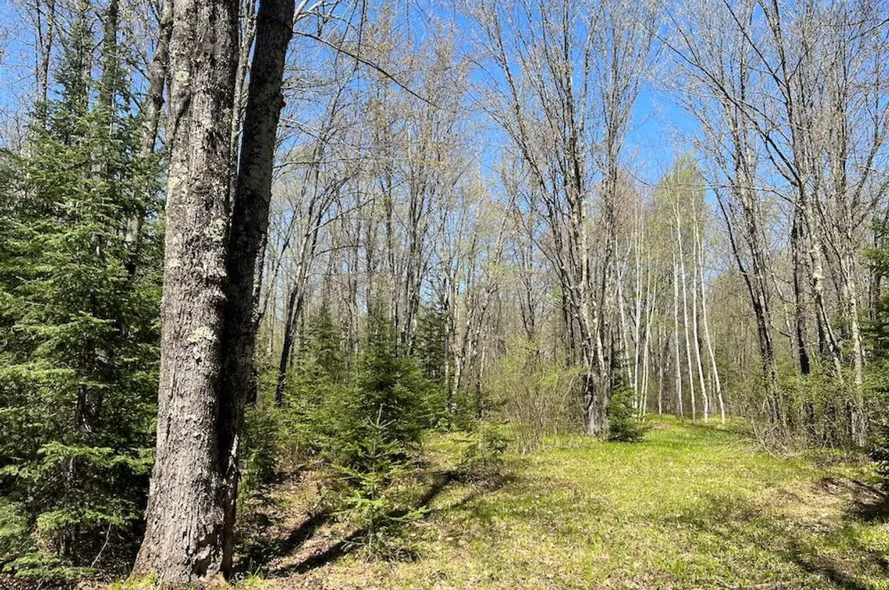
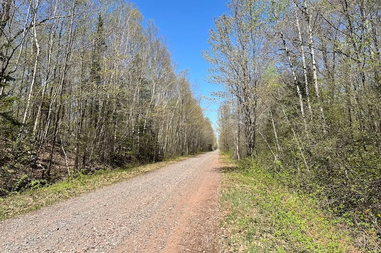
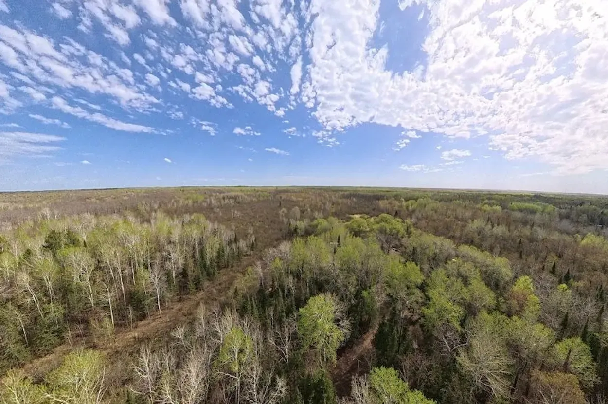
Source media: Whitetail Properties listing. Images are presented for property-review context.
Executive Summary
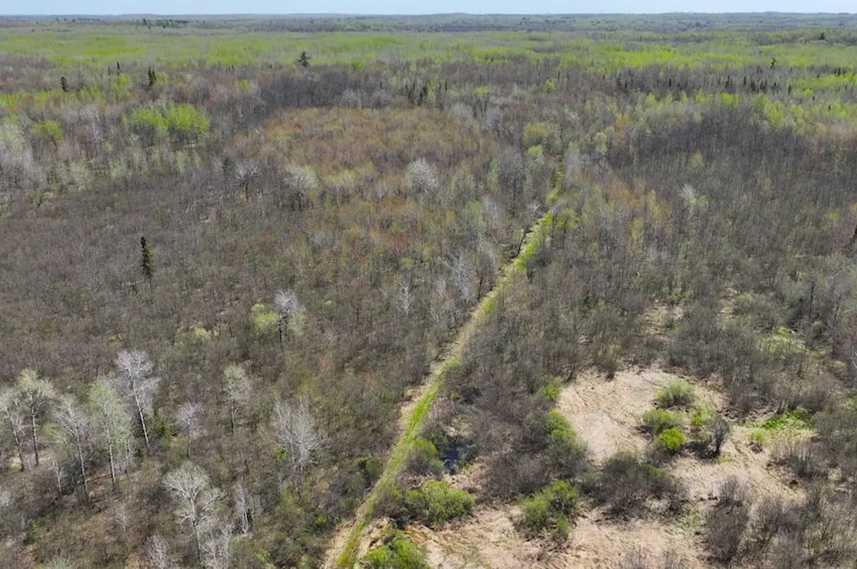
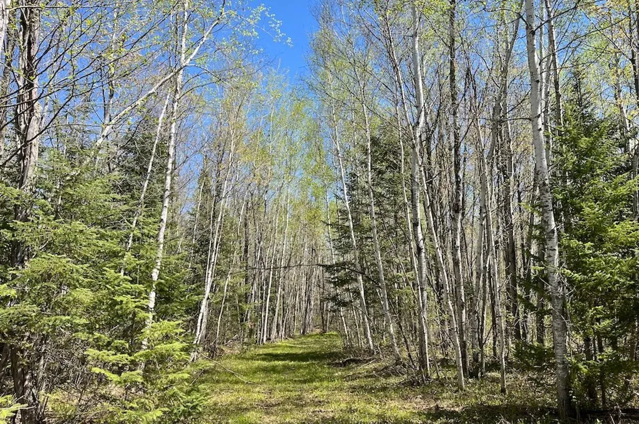
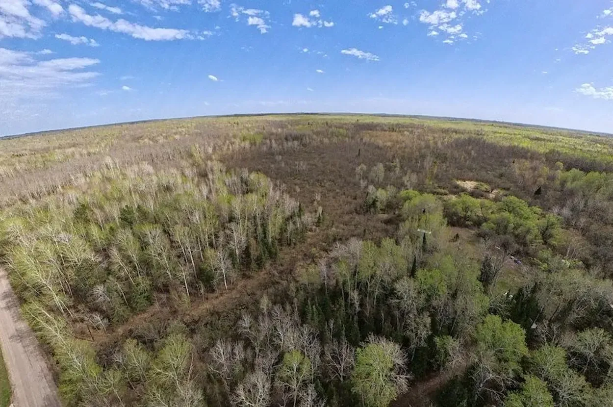
This Whitetail Properties listing is a 275.68± acre tract in Douglas County, Wisconsin, near Superior and roughly inland from the Lake Superior South Shore. The listing describes a mix of mature maple, oak, spruce, aspen, and black ash, with regenerating aspen and balsam fir, mostly high ground, pockets of lower heavy cover, an established trail system, food plots, and enclosed blinds.
From a Resilience Atlas perspective, the property is interesting because it offers scale, privacy, timber, internal movement, wildlife habitat, and a strong northern-watershed story at a price point that is far below many turnkey rural estates. It is not, however, a turnkey homestead. The listing says electric, water, and internet are nearby, but not onsite. It also flags creek/spring features without proving whether they are permanent, legally usable, or cleanly located on buildable ground.
The strongest case for this property is as a long-term wildland retreat or cabin-base candidate: a place where a buyer could prioritize privacy, woods, trail access, hunting, wood heat, backup power, and a modest buildout. The main caution is that northern Wisconsin land can carry hidden practical constraints — wetlands, shoreland/wetland rules, winter access, utility-extension cost, short growing season, and drainage limitations.
Initial Verdict:
🟡 Conditional Candidate. Worth deeper due diligence for buyers who want large-acreage privacy near the Lake Superior watershed, but not a property to treat as build-ready until county, utility, water, wetland, and access questions are answered.
Key Strengths
- Large 275.68± acre land base with strong privacy and habitat value.
- Township road frontage and gravel-road access, according to the listing.
- Existing trail/internal road system, food plots, and enclosed blinds reduce first-phase land-prep work.
- Cleared building-location signal with nearby power mentioned in the listing.
- Strong regional story: northern Wisconsin timberland situated between Lake Superior tributary systems.
Key Concerns
- Creek/spring and water claims are unverified; potable-water plan is unknown.
- Nearby electric, water, and internet do not equal onsite service; extension cost could be material.
- Wetlands, drainage, floodplain, and northern Wisconsin land-use restrictions need careful checking.
- Winter road access, snow maintenance, emergency response time, and cellular coverage are unknown.
- Food-production potential is more limited than warmer or already improved homestead properties.
Location Analysis
Regional Context
The property is in Douglas County, Wisconsin, near Superior and the western Lake Superior region. The listing places it in T 47 N – R 12 W, Sections 29 and 30, with coordinates at 46.5278, -91.9114. Straight-line distance is approximately 26.0 km / 16.2 miles from Superior, WI, approximately 32.2 km / 20.0 miles from Duluth, MN, and approximately 11.0 km / 6.8 miles from Poplar, WI. Actual driving distances may be longer and should be checked against the access route.
The Lake Superior South Shore context matters for climate, snow, forest composition, water movement, and long-term land use. This is not a mild-climate homestead. It is better understood as a northern woods property where heat, access, snow load, drainage, equipment storage, and maintenance planning become central.
Access and Roads
The listing reports township road frontage, gravel road surface, excellent access from the Brannan Road entrance, and an internal trail/road system. Those are strong access signals for a large tract, but they remain listing claims. A buyer should confirm legal frontage, driveway permissions, road maintenance responsibilities, culvert requirements, plowing expectations, and whether emergency vehicles can reach the intended build site in winter.
Distance to Services
Using the listing coordinates, the property appears approximately 26.0 km / 16.2 miles straight-line from Superior, WI and approximately 32.2 km / 20.0 miles straight-line from Duluth, MN. Those communities are the likely service anchors for major groceries, hardware/building supplies, hospital/urgent care, fuel, and regional logistics. Poplar, WI is approximately 11.0 km / 6.8 miles straight-line and may provide closer small-town services. These are map-based approximations only; road travel times should be verified.
Land and Terrain
Acreage Usefulness
At 275.68± acres, the land base is the primary asset. The listing describes mostly high ground with pockets of lower heavy cover, timber, pasture, tillable signals, food plots, and a cleared potential building location. That combination suggests good recreational and privacy value, but it also means the usable acreage for gardens, structures, and year-round access may be much smaller than the headline acreage until soils, wetlands, slopes, and drainage are mapped.
Soil and Growing Potential
The listing references pasture and tillable land, but does not provide soil types, drainage ratings, crop history, or garden suitability. Northern Wisconsin’s short growing season and wet pockets can limit food-production plans. A practical buyer should review USDA Web Soil Survey data, request any prior land-management records, and test the specific cleared/buildable areas before assuming orchard, livestock, or market-garden potential.
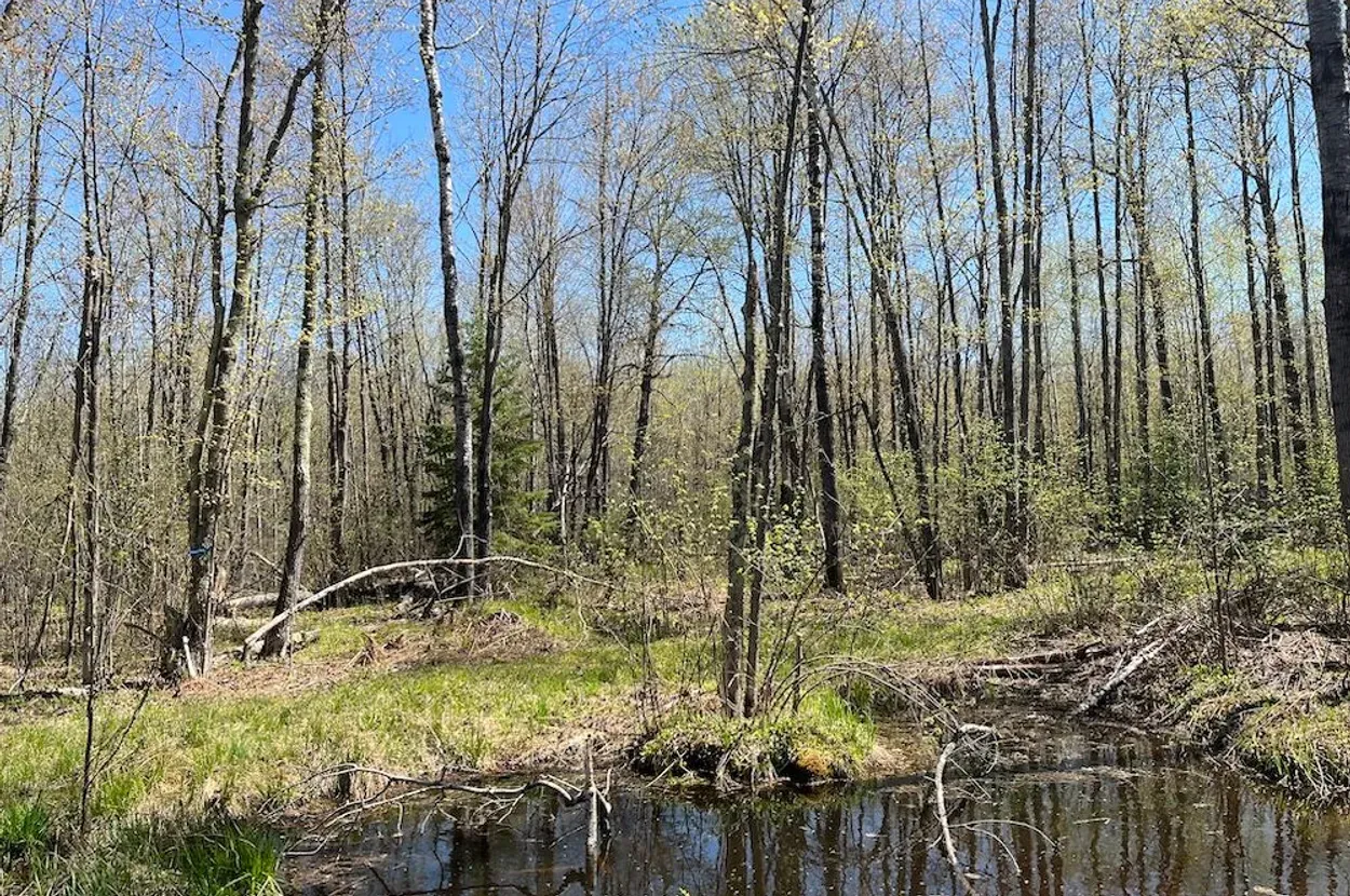
Water Features
Whitetail lists creek/spring features and places the land between the Amnicon River and Middle River Lake Superior tributaries. That is a meaningful water-story signal, but not a verified domestic-water solution. The key due diligence questions are whether water is on-parcel, perennial, legally usable, outside regulated wetland buffers, and suitable for wildlife or emergency non-potable use. A well plan or verified water service would still be needed for residential use.
Utilities and Infrastructure
Power
The listing says electric is nearby and mentions power near the cleared building location. That is helpful, but the distance to the nearest pole, line-extension cost, easements, transformer needs, and utility service requirements are unknown. Solar with battery backup could make sense for a cabin-scale plan, but grid-extension economics should be priced before purchase.
Water
The listing says water is nearby and separately mentions creek/spring features. It does not confirm a well, public water hookup, water meter, tested potable source, or year-round flow. Water security is therefore conditional: promising for landscape and wildlife value, not yet proven for a homestead.
Septic and Waste
No septic system, perc test, or sanitary permit is listed. Douglas County/site-specific rules, soil suitability, setbacks from wetlands or watercourses, and winter installation constraints should be verified before treating the cleared location as a residential build site.
Internet and Communications
The listing says internet is nearby, but the provider, technology, speed, installation distance, and reliability are unknown. The FCC Broadband Map, provider calls, an onsite cell test, and Starlink obstruction review should all be part of due diligence. For resilience use, radio communications and a backup power plan for connectivity would also matter.
Off-Grid and Resilience Potential
Solar Suitability
The timbered setting may limit easy solar exposure unless the cleared building location has enough southern sky. A ground-mounted array near the clearing could be feasible if tree shading and snow management are handled. Battery storage and a generator backup would likely be more practical than solar alone.
Heating and Cooling
Wood heat is a natural fit for this timberland setting, but responsible fuelwood harvesting, insurance requirements, chimney safety, and backup heat should be planned. Cooling is less likely to dominate than cold-weather durability, snow load, freeze protection, and wet-season moisture management.
Food Production Potential
Food production is possible, but not the property’s strongest first-use category. Gardens, a greenhouse, cold-hardy orchard experiments, poultry, or small livestock might work near the cleared/tillable areas if soils, water, fencing, and predator pressure are addressed. Compared with milder homestead properties, this is more of a woodlot/hunting/privacy tract than a ready food-production base.
Security and Privacy
The scale, timber, internal trails, and mixed high/low cover create strong privacy potential. The practical security value is not about fear-based defensibility; it is about distance from neighbors, controlled access, awareness of approach routes, and enough land to manage visibility. Multiple access points, boundary clarity, and gates should be verified.
Legal, Zoning, and Buildability
Zoning
Zoning is not stated in the extracted listing text. Because the property is in northern Wisconsin with possible wetland, forestry, agricultural, and shoreland-related considerations, zoning should be checked directly with Douglas County before assuming residential, cabin, RV, tiny-home, camping, or multi-structure use.
Permits and Restrictions
Confirm survey/boundaries, legal access, driveway permits, culverts, wetlands, floodplain status, shoreland/wetland setbacks, timber rights, enrolled land-management or tax programs, easements, mineral rights, and any recorded covenants. The listing itself says measurements, access, utilities, acreage, and mapping boundary lines have not been independently verified.
Risk Assessment
Environmental Risks
The main environmental risks are wetland/drainage constraints, flooding or seasonal water movement in lower pockets, wildfire/smoke risk, extreme cold, heavy snow, wind exposure, and erosion or trail degradation. The Lake Superior watershed setting is attractive, but it also demands careful hydrology and wetlands review.
Financial / Practical Cost Risks
The purchase price may look accessible for 275.68± acres, but the practical cost risk is in development: road/driveway work, power extension, well drilling, septic design, winterized shelter, equipment storage, insurance, ongoing land management, and snow access. Buyers should price the first two years of work before assuming the land is affordable to use.
Practical Risks
This property may be too raw for buyers who want immediate homestead use. It is better suited to someone comfortable with staged development, winter planning, tools/equipment, remote-property logistics, and professional due diligence. Communications and emergency access should be verified early.
Estimated Development Path
Phase 1: Due Diligence
Confirm zoning, legal access, survey, driveway permissions, wetlands/floodplain, water/well options, septic/perc feasibility, utility-extension costs, internet/cell coverage, timber/tax-program status, and insurance availability. Walk the property in wet conditions if possible, not only in dry weather.
Phase 2: Basic Use
Secure access, mark boundaries, improve trail drainage where needed, identify the highest and driest build/camp area, test communications, set up locked storage, obtain well/septic quotes, and design a small solar/generator communications and tool-power setup.
Phase 3: Resilient Buildout
Develop a modest cabin or home site, install water and septic, add solar plus battery and backup generator, create a greenhouse or protected garden area, manage woodlot/fuel, maintain trails, and establish a weather-aware communications plan.
Property Scorecard
The listing claims creek/spring features and nearby water, but potable supply, seasonality, wetlands, and actual on-parcel water rights still need verification.
A large 275.68± acre tract with timber, habitat cover, and internal trails should provide substantial privacy compared with smaller rural parcels.
Pasture/tillable signals and food plots help, but the northern climate, wet pockets, soil limits, and lack of verified domestic water reduce near-term food-production certainty.
Access, trail network, enclosed blinds, food plots, a cleared building location, and nearby power are meaningful starts; no house, well, septic, or confirmed utility service is listed.
The acreage, timber, privacy, solar/wood-heat potential, and build-site signal are strong, but permanent water, septic, and winter access must be resolved.
The listing says internet is nearby, but provider, speed, cellular coverage, and backup communications options are unverified.
High ground mixed with lower heavy cover, trails, and limited visibility support practical privacy and situational awareness without overstating security claims.
Lake Superior watershed context can moderate some conditions, but heavy snow, cold, wetland/drainage issues, and short growing season are real planning constraints.
The land base is large enough for woodlot use, hunting, gardens, trails, and a cabin or homestead plan, but it is not yet a turnkey self-reliance property.
A large northern Wisconsin wildland near Lake Superior, with timber diversity and habitat structure, gives the report a strong regional identity.
The scale, Northwoods setting, trail system, and Lake Superior South Shore positioning are compelling for readers who want privacy and wildland resilience.
Township road frontage, gravel access, and a cleared build location are positives; zoning, wetlands, shoreland rules, survey, and utility-extension cost remain unresolved.
76/120 overall. This is a strong wildland/privacy story, but it remains conditional because water, wetlands, buildability, and utility-extension details are not verified.
Rating: 🟡 Conditional Candidate
Final Recommendation
🟡 Conditional Candidate
This property deserves deeper investigation if the buyer’s goal is privacy, northern woods access, hunting/recreation, a future cabin or retreat, and a long-term land base near the Lake Superior region. It is especially interesting for a Resilience Atlas audience because it is not merely acreage on paper; it has a real landscape story, internal access, habitat structure, and a plausible staged-build path.
The recommendation is conditional because the most important residential-use questions are unresolved. The buyer should not treat nearby utilities, creek/spring language, or a cleared build location as proof of build readiness. Water, septic, wetlands, zoning, winter access, and utility costs are the make-or-break issues.
Rating context: Candidate levels reflect how well the property fits Resilience Atlas criteria after weighing infrastructure, water, access, buildability, communications, risk, and unresolved due diligence.
Questions to Ask Before Moving Forward
- Is legal access from Brannan Road fully confirmed by deed, survey, and county records?
- What is the exact zoning, and are cabins, homes, RV use, accessory structures, and off-grid systems allowed?
- Where are wetlands, floodplain, and regulated water features relative to the cleared building location?
- Is the creek/spring on the parcel, perennial, and legally usable?
- What would a well cost at the preferred build site, and what are neighboring well depths/yields?
- Has a perc test or sanitary site evaluation been completed?
- What is the actual distance and quoted cost for electric service?
- Which internet providers can serve the build site, and what speeds are available?
- How reliable is cellular coverage on the property?
- Who maintains/plows the access route in winter?
- Are there timber, managed-forest, conservation, easement, or tax-program restrictions?
- Are annual taxes, insurance availability, and any road/association obligations confirmed?
Source and Due-Diligence Starting Points
- Listing: Whitetail Properties — Phenomenal Whitetail Habitat Near The Lake Superior South Shore.
- Map coordinates: 46.5278, -91.9114 on Google Maps.
- County records/GIS: Start with Douglas County, Wisconsin land records, zoning, tax, and GIS offices for parcel boundaries, zoning, taxes, access, and recorded restrictions.
- Flood/wetlands: Check FEMA Flood Map Service Center and Wisconsin wetland/waterway layers before assuming the cleared area is buildable.
- Soils: Review USDA Web Soil Survey for drainage, septic suitability, woodland productivity, and garden limitations.
- Broadband: Review FCC Broadband Map at the listing coordinates, then call providers directly.
- Utilities: Ask the local electric utility and any nearby water/internet provider for written extension estimates to the intended build site.
Due diligence note: Whitetail Properties states that listing information is deemed reliable but not warranted or guaranteed, and that access, utilities, measurements, acreage, square footage, frontage, and boundary lines should be independently investigated by prospective buyers. This report treats listing claims as unverified leads until confirmed.