How to read this report
Land listings are easy to romanticize. A few photos, a low monthly payment, a mountain view, a stream, a phrase like “off-grid” or “no HOA” — and suddenly a parcel starts to feel like a plan.
Resilience Atlas looks at land differently.
The question is not “should you buy this?” The question is: what would a serious buyer need to verify before treating this property as a preparedness, retreat, homestead, or self-reliance asset?
This report reviews five current LandFlip listings selected for editorial study across five different resilience-property archetypes:
- Colorado high-country basecamp
- Tennessee connected rural retreat
- Upstate New York large woodland stewardship tract
- Western North Carolina mountain-stream retreat
- West Texas desert/off-grid acreage
The listings were selected because they preserve the original LandFlip URL, include usable listing images, sit in the United States, and contain enough listing detail to support a sourced property-intelligence report. The broader criteria brief for this project does not specify a minimum acreage, price cap, required water source, preferred state, or exact zoning requirement. It calls for North America-focused, resilience/preparedness/off-grid/rural-property editorial analysis with clear caveats and no invented facts.
Important caveat: Resilience Atlas does not broker property and has not independently verified seller or LandFlip claims. Listing status, price, acreage, access, utilities, zoning, restrictions, taxes, title, water, septic, hazards, and insurance should be verified directly with the listing source, county offices, title professionals, surveyors, utility providers, insurers, and qualified local experts before anyone relies on them. This article is editorial research, not legal, financial, tax, insurance, engineering, construction, surveying, title, or investment advice.
Quick comparison table
| Rank | Archetype | LandFlip listing | Location | Acreage | Listed price | Why it made the cut |
|---|---|---|---|---|---|---|
| 1 | High-country basecamp | #418641 | Fort Garland, Costilla County, Colorado | 5.27 acres | $18,999 | Affordable mountain parcel with listing claims around legal access, county-maintained road access, Estate Residential zoning, no mandatory HOA dues, and high-elevation retreat potential. |
| 2 | Connected rural retreat | #412838 | Dover, Stewart County, Tennessee | 15.70 acres | $133,450 | Rural acreage with listing claims of road access, mature trees, power, high-speed fiber internet, no HOA, and proximity to Land Between the Lakes. |
| 3 | Large woodland stewardship | #413752 | Salem, Washington County, New York | 186.50 acres | $373,000 | Large wooded acreage with listing claims of access, power, trails, mature hardwood forest, agricultural zoning, and two tracts. |
| 4 | Appalachian stream retreat | #418766 | Murphy, Cherokee County, North Carolina | 8 acres | $38,888 | Small mountain retreat with listing claims of stream frontage, long-range views, wide-road access, and limited restrictions. |
| 5 | Desert/off-grid acreage | #403375 | Sierra Blanca, Hudspeth County, Texas | 20 acres | $38,900 | Budget desert acreage with listing claims around off-grid use, roads/easy access, survey/road signs, owner financing, and homestead/recreation use. |
The ranking is editorial, not financial. It reflects how useful each listing is as a teaching example for resilience-oriented land evaluation.
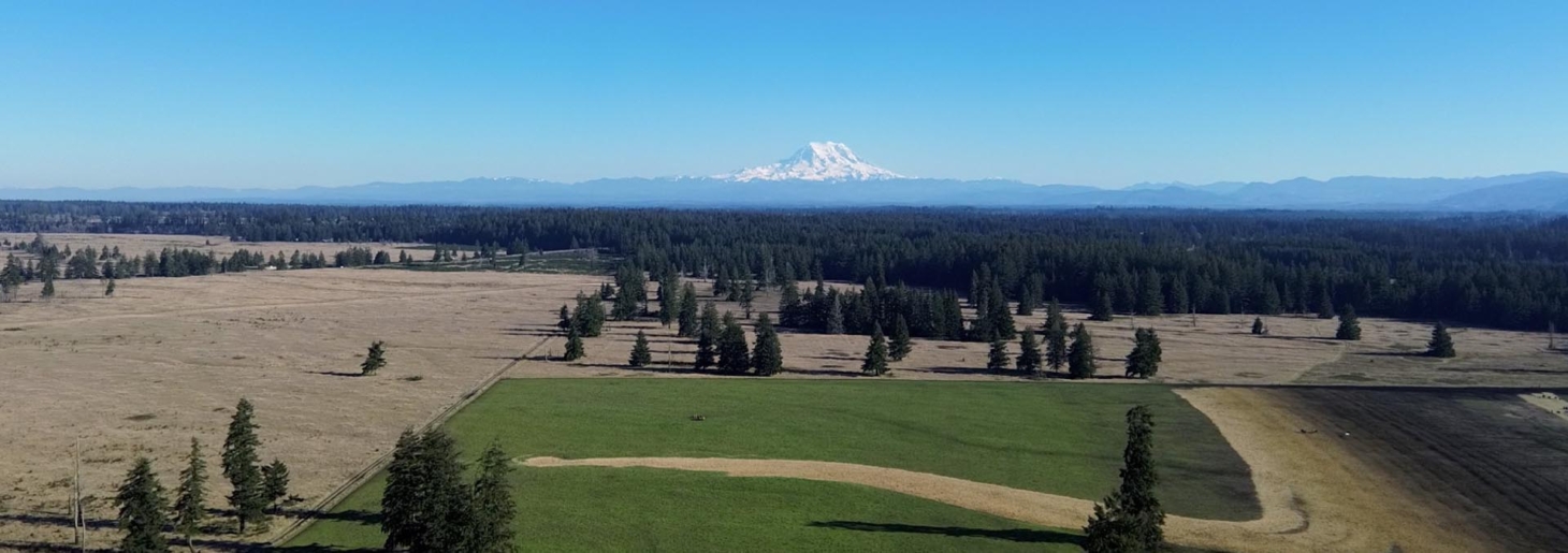
1. Colorado: the high-country basecamp candidate

Image source: LandFlip listing #418641, listing by Collin Pettet of Wild Domain, LLC. Verify image reuse/credit requirements before publication.
Listing snapshot
- LandFlip title: “5.27 Acres CO Mountains 279 Down”
- Listing URL: https://www.landflip.com/land/418641
- Listed location: 2049 Pfotenhauer Rd, Fort Garland, CO 81133; Costilla County, Colorado
- Acreage: 5.27 acres
- Listed price: $18,999 USD
- Seller/broker shown by LandFlip: Collin Pettet of Wild Domain, LLC
- Property type shown by LandFlip: land for sale by owner
Why it fits the resilience lens
This is the classic “small mountain basecamp” case study. The LandFlip listing positions the parcel in the Sangre de Cristo Ranches area near Fort Garland and describes it as a high-elevation mountain parcel at approximately 8,520–8,550 feet. The listing also claims direct access from county-maintained Pfotenhauer Road, Estate Residential zoning, confirmed legal access, no mandatory HOA dues, and annual taxes of $212.48.
Those details make the parcel editorially interesting because they combine three things rural buyers often seek: low acquisition cost, mountain-recreation appeal, and a plausible retreat/cabin narrative.
But the same features that make it attractive also create the real due-diligence burden. At 8,500+ feet, winter access, freeze depth, water logistics, heating fuel, emergency response, wildfire exposure, solar design, and insurance are not side notes. They are core operating constraints.
What to verify before you fall in love with it
- Confirm the assessor parcel number, legal description, and boundaries match the advertised Lot 2049, Block 126, Sangre de Cristo Ranches Unit L.
- Confirm Estate Residential zoning and permitted uses with Costilla County Planning & Zoning.
- Confirm whether camping, RV use, cabin construction, septic, wells, cisterns, and driveway work are allowed on this specific parcel.
- Confirm whether Pfotenhauer Road is public, private, county-maintained, seasonal, or subject to subdivision/POA obligations.
- Confirm “no mandatory HOA dues,” any covenants, any greenbelt rights, and any road or special-district assessments through recorded documents.
- Confirm wildfire exposure, defensible-space requirements, insurance availability, and winter emergency access.
- Confirm water options: well depth/cost, hauled water, cistern rules, and water quality.
Resilience Atlas read
This is not a “cheap land solves everything” property. It is a cold-climate, high-elevation logistics problem wrapped in a beautiful mountain setting. If the legal access, road maintenance, zoning, water, septic, and winter-use assumptions check out, it could be a compelling seasonal cabin or basecamp candidate. If they do not, the low listed price can quickly become a distraction.
Sources: LandFlip #418641, Costilla County, Costilla County Planning & Zoning resources
2. Tennessee: the connected rural-retreat candidate

Image source: LandFlip listing #412838, listing by LANDiO. Verify image reuse/credit requirements before publication.
Listing snapshot
- LandFlip title: “15.7 Acres, Power & Fiber Internet”
- Listing URL: https://www.landflip.com/land/412838
- Listed location: Cox Hollow Road, Dover, TN 37058; Stewart County, Tennessee
- Acreage: 15.70 acres
- Listed price: $133,450 USD
- Seller/broker shown by LandFlip: LANDiO
- Property type shown by LandFlip: land for sale by owner
Why it fits the resilience lens
This is the “resilient but connected” example. The LandFlip listing says Freedom Ridge Dover lots have road access, mature trees, power, and high-speed fiber internet. It also claims no HOA or HOA fees, no time limit to build, recreational/seasonal/full-time use, possible livestock use, and a development path using a drilled well and septic system.
That makes it different from the romantic off-grid listings. For many people, practical resilience is not about disappearing from the grid. It is about having rural acreage, communications, power, workspace, and enough land to support redundancy without giving up modern connectivity.
The location also carries a strong lifestyle hook. The listing says Freedom Ridge Dover is between Kentucky Lake and Lake Barkley and less than three miles from the south boundary of Land Between the Lakes National Recreation Area. Land Between the Lakes is an official National Recreation Area with public recreation information and infrastructure.
What to verify before you fall in love with it
- Confirm the exact lot, legal description, and whether Freedom Ridge Dover is a platted subdivision.
- Confirm utility reality at the build site: power provider, nearest pole, fiber provider, easements, installation costs, and written service availability.
- Confirm recorded restrictions. “No HOA” does not always mean “no covenants.”
- Confirm whether RV use, livestock, multiple structures, cabins, tiny homes, short-term rental, and full-time residence are allowed.
- Confirm well depth/cost history with licensed local drillers, not only seller examples.
- Confirm septic suitability with the relevant county/environmental health office.
- Check FEMA flood maps, drainage, storm exposure, wet-weather road access, and emergency response time.
Resilience Atlas read
This is one of the strongest practical-use examples because connectivity is part of the value proposition. If power and fiber can be verified in writing, the parcel may be more realistic for remote work and communications resilience than many “pure off-grid” properties. The caution is that infrastructure claims are only useful if they are specific to the parcel and affordable to connect at the intended build location.
Sources: LandFlip #412838, Stewart County, Dover, TN Codes, Planning & Zoning, Land Between the Lakes
3. New York: the large-woodland stewardship candidate

Image source: LandFlip listing #413752, listing by LANDiO. Verify image reuse/credit requirements before publication.
Listing snapshot
- LandFlip title: “186 Wooded Acres w Access & Power”
- Listing URL: https://www.landflip.com/land/413752
- Listed location: 97 Sky Parlor Road, Salem, NY 12865; Washington County, New York
- Acreage: 186.50 acres
- Listed price: $373,000 USD
- Seller/broker shown by LandFlip: LANDiO
- Property type shown by LandFlip: land for sale by owner
Why it fits the resilience lens
This is the “land base” example. The LandFlip listing describes 186.5 wooded acres in Washington County, New York, with access and power, lightly cleared trails, mature hardwood forest, wildlife habitat, agricultural zoning, and two tracts: approximately 64.2 acres within Salem town limits and 122.3 acres outside Salem town limits.
That scale changes the conversation. Smaller parcels are often about a homesite or retreat cabin. A 186.5-acre wooded tract can raise broader questions: timber management, privacy, internal trails, hunting/recreation, food systems, land stewardship, boundary control, tax classification, wetlands, forest health, invasive species, and long-term family or community use.
But scale does not remove complexity. It multiplies it.
What to verify before you fall in love with it
- Confirm whether the advertised acreage is one deed, two deeds, two tax parcels, or multiple legal interests.
- Confirm which acreage is inside Salem town limits and which rules apply to each portion.
- Confirm agricultural zoning and allowed uses with Town of Salem and Washington County records.
- Confirm the location and cost of power service and whether it depends on easements.
- Confirm wetlands, streams, floodplain, DEC jurisdiction, steep slopes, and any protected environmental constraints.
- Confirm timber rights, timber value, recent logging history, mineral rights, forest tax program status, and management obligations.
- Confirm road frontage, driveway permits, gates, encroachments, leases, hunting permissions, winter access, and emergency access.
Resilience Atlas read
This is the most strategic property in the set, but also the least “simple.” If the tracts, access, zoning, timber, wetland, and tax questions are clean, the property could serve as a serious long-term woodland stewardship case study. If those issues are unclear, the acreage number alone is not enough. Large rural parcels demand professional-grade diligence.
Sources: LandFlip #413752, Washington County GIS Web Map, Washington County Image Mate Online, Town of Salem, Town of Salem zoning law PDF
4. North Carolina: the Appalachian stream-retreat candidate

Image source: LandFlip listing #418766, listing by Charles Payne. Verify image reuse/credit requirements before publication.
Listing snapshot
- LandFlip title: “Idyllic & Private 8 Ac. Mtn Retreat”
- Listing URL: https://www.landflip.com/land/418766
- Listed location: 1 Idyllic Way, Murphy, NC 28906; Cherokee County, North Carolina
- Acreage: 8 acres
- Listed price: $38,888 USD
- Seller/broker shown by LandFlip: Charles Payne
- Property type shown by LandFlip: land for sale by owner
Why it fits the resilience lens
This is the “small Appalachian retreat with a water feature” example. The LandFlip listing claims 8 usable acres, approximately 221 feet of cold mountain stream frontage, long-range views, wide-road access, no major restrictions, and potential for RVing, camping, or building. The listing also references proximity to Lake Hiwassee, Apalachia Lake, Cherokee Lake, Nottely Lake, Murphy, Blairsville, and McCaysville.
The LandFlip “More Land Details” section, as captured in the research dossier, also lists gravel road access, electricity service, cell service, broadband internet service, and well water. That is useful, but it still needs careful interpretation. “Well water” could mean an existing well, area feasibility, or a nearby/available water situation; a buyer would need to verify the exact parcel-level status.
What to verify before you fall in love with it
- Confirm the legal description, parcel number, acreage, and whether “1 Idyllic Way” is a formal address or a marketing address.
- Confirm the claimed 221+/- feet of stream frontage by survey.
- Confirm whether any portion lies in FEMA floodplain, riparian buffer, or local flood-hazard area.
- Confirm buildable envelope, slope, driveway grade, drainage, and landslide susceptibility.
- Confirm septic feasibility and whether there is an existing well; if so, verify depth, yield, water quality, and condition.
- Confirm electricity, broadband, and cell availability at the actual homesite, not just nearby.
- Confirm deed restrictions, “no major restrictions” language, road maintenance agreements, subdivision obligations, and any POA-like arrangements.
Resilience Atlas read
This is visually and emotionally strong: mountains, water, privacy, and a smaller price point than the Tennessee or New York examples. The risk is that mountain-stream properties can hide technical constraints. Stream buffers, floodplain, driveway grade, septic location, slope stability, and road maintenance can determine whether a beautiful parcel is buildable in practice.
Sources: LandFlip #418766, Cherokee County NC GIS Data Gateway, Cherokee County NC GIS, North Carolina DEQ landslide resources
5. Texas: the desert/off-grid acreage candidate

Image source: LandFlip listing #403375, listing by Texas Land Buys. Verify image reuse/credit requirements before publication.
Listing snapshot
- LandFlip title: “20 Acres in The Foothills $289/Mo”
- Listing URL: https://www.landflip.com/land/403375
- Listed location: Sierra Blanca, TX 79851; Hudspeth County, Texas
- Acreage: 20 acres
- Listed price: $38,900 USD
- Seller/broker shown by LandFlip: Texas Land Buys
- Property type shown by LandFlip: land for sale by owner
Why it fits the resilience lens
This is the “budget desert self-reliance” example. The LandFlip listing claims a foothill cul-de-sac location, off-grid suitability, ranching/hunting/homesite/recreation potential, roads/easy access with survey and road signs, no zoning/use-anything language, owner financing, and mountain views.
It is also the listing where the caveats matter most. Cheap desert acreage can be legitimately useful for the right person with the right plan. It can also become a trap if water, road access, title, septic, heat, flooding, emergency services, and financing terms are not understood before purchase.
The listing geocodes at town level because no parcel street address is provided in the research dossier. The dossier notes an approximate straight-line distance from Sierra Blanca to El Paso of about 78 miles using OpenStreetMap/Nominatim town geocoding and haversine calculation, but that should not be presented as parcel-to-city travel time.
What to verify before you fall in love with it
- Confirm exact GPS coordinates, parcel ID, legal description, survey, and whether the advertised road reaches the specific 20 acres.
- Confirm road status: public, private, platted, easement-only, maintained, passable after storms, and accessible to emergency vehicles.
- Confirm water options: well depth, yield, cost, nearby well data, hauling source, storage legality, and water quality.
- Confirm septic/permitting requirements and soil suitability.
- Confirm mineral rights, surface rights, grazing/hunting rights, easements, restrictions, and any subdivision/road obligations.
- Confirm owner-financing terms: total payoff, interest, default clauses, title transfer timing, fees, and refund/inspection terms.
- Confirm wildfire/grassfire, extreme heat, flood/arroyo, isolation, communications, and emergency-response risks.
Resilience Atlas read
This is the purest off-grid archetype in the group and the clearest example of why “off-grid” is not automatically resilient. Water is the central question. If potable water, road access, septic legality, communications, emergency access, and financing terms are all workable, the acreage may be interesting. If not, the low monthly payment is noise.
Sources: LandFlip #403375, Hudspeth County forms/applications, Texas Water Development Board groundwater resources, FEMA Flood Map Service Center
The due-diligence checklist to use on every rural listing
Before treating any rural parcel as a resilience asset, build a one-page verification file around these questions:
1. Identity and title
- What is the assessor parcel number?
- What is the legal description?
- Does the advertised acreage match county and title records?
- Is the parcel one legal tract or multiple tracts?
- Are there easements, encroachments, liens, leases, mineral reservations, or access agreements?
2. Access
- Is access legal, physical, and year-round?
- Is the road public, private, county-maintained, seasonal, platted, or easement-only?
- Who maintains it, who pays, and what happens after storms or snow?
- Can emergency vehicles reach the likely homesite?
3. Water
- Is there an existing well, community water, spring, stream, or hauled-water plan?
- If a well is needed, what do nearby well logs suggest about depth, yield, water quality, and cost?
- Are cisterns, rain catchment, hauling, or storage allowed?
- Are there water rights, riparian rules, or groundwater restrictions?
4. Waste and soil
- Has the land passed a perc or septic evaluation?
- Where could a legal septic system go relative to slope, water, setbacks, and build site?
- Are composting toilets, outhouses, RV systems, or alternative systems allowed?
5. Land use and restrictions
- What zoning district applies?
- Are there covenants even if there is no HOA?
- Are RVs, camping, tiny homes, livestock, multiple structures, hunting, short-term rental, workshops, and agriculture allowed?
- Are permits needed for driveway, grading, well, septic, building, culverts, stream crossings, or tree clearing?
6. Hazards and insurability
- What do FEMA flood maps show?
- Are there wildfire, landslide, hurricane, tornado, extreme heat, winter-road, drought, or drainage issues?
- Can the property be insured for the intended use?
- What are the defensible-space, fire-access, and local emergency constraints?
7. Operating costs
- What are current taxes and special assessments?
- What would power, solar, driveway, well, septic, fencing, road work, internet, heating fuel, and insurance realistically cost?
- If seller financing is offered, when does title transfer and what happens on default?
Source links
LandFlip listings
- Colorado — LandFlip #418641: https://www.landflip.com/land/418641
- Tennessee — LandFlip #412838: https://www.landflip.com/land/412838
- New York — LandFlip #413752: https://www.landflip.com/land/413752
- North Carolina — LandFlip #418766: https://www.landflip.com/land/418766
- Texas — LandFlip #403375: https://www.landflip.com/land/403375
Official/public verification starting points
- Costilla County: https://www.costillacounty.gov/
- Costilla County Planning & Zoning resources: https://www.costillacounty.gov/planning-and-zoning/page/planning-zoning-resources
- Stewart County: https://www.stewartcogov.com/
- Dover, TN Codes, Planning & Zoning: https://www.dovertn.com/codes_planning_zoning.html
- Land Between the Lakes National Recreation Area: https://landbetweenthelakes.us/
- Washington County NY GIS Web Map: https://www.washingtoncountyny.gov/270/GIS-Web-Map
- Washington County NY Image Mate Online: https://www.washingtoncountyny.gov/271/Image-Mate-Online
- Town of Salem, NY: https://townofsalemny.gov/
- Town of Salem zoning law PDF: https://townofsalemny.gov/wp-content/uploads/2026/02/Zoning-Law-of-the-Town-of-Salem-Local-Law-4-of-2024.pdf
- Cherokee County NC GIS Data Gateway: https://cherokeecounty-nc-gis-ccncgis.opendata.arcgis.com/
- Cherokee County NC GIS: https://www.cherokeecounty-nc.gov/191/Geographic-Information-Systems
- North Carolina DEQ landslide resources: https://www.deq.nc.gov/about/divisions/energy-mineral-and-land-resources/north-carolina-geological-survey/geologic-hazards/landslides
- Hudspeth County forms/applications: https://www.co.hudspeth.tx.us/page/hudspeth.Forms.and.Applicatons
- Texas Water Development Board groundwater resources: https://www.twdb.texas.gov/groundwater/
- FEMA Flood Map Service Center: https://msc.fema.gov/portal/home
- OpenStreetMap/Nominatim was used in the research dossier only for rough orientation, not legal boundary/access claims: https://nominatim.openstreetmap.org/
Final word
The best rural-property research does not start with the fantasy. It starts with the failure modes.
Can you reach it? Can you legally use it? Can you get water? Can you handle waste? Can you insure it? Can emergency services find it? Can the road survive weather? Can the title be transferred cleanly? Can the parcel support your actual use case rather than the listing’s best-case story?
That is the Resilience Atlas standard: not anti-dream, but pro-verification.
If you want more reports like this — with listings, caveats, verification paths, and preparedness-focused evaluation frameworks — join Resilience Atlas and follow the next property-intelligence drop.