Executive summary
- Small mountain parcel with a low listed price and strong seasonal retreat/basecamp appeal.
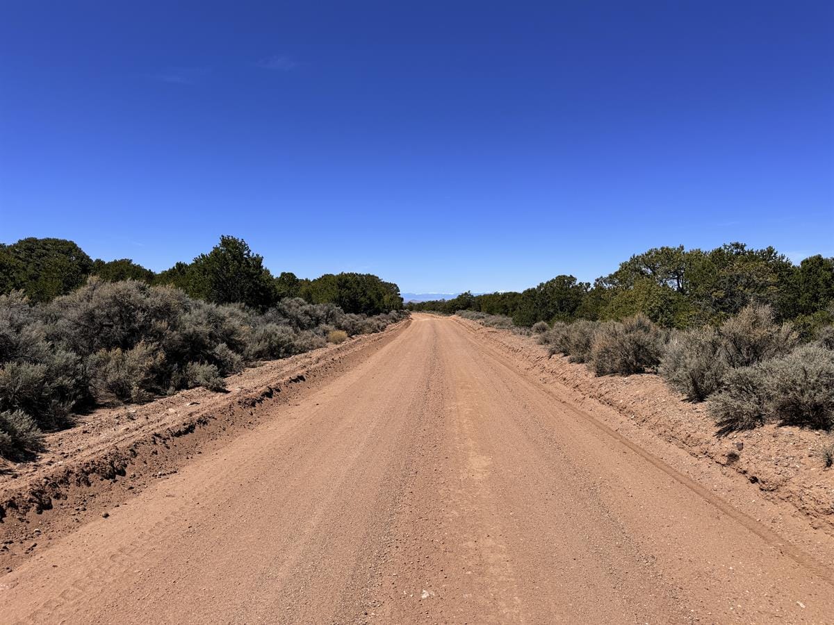
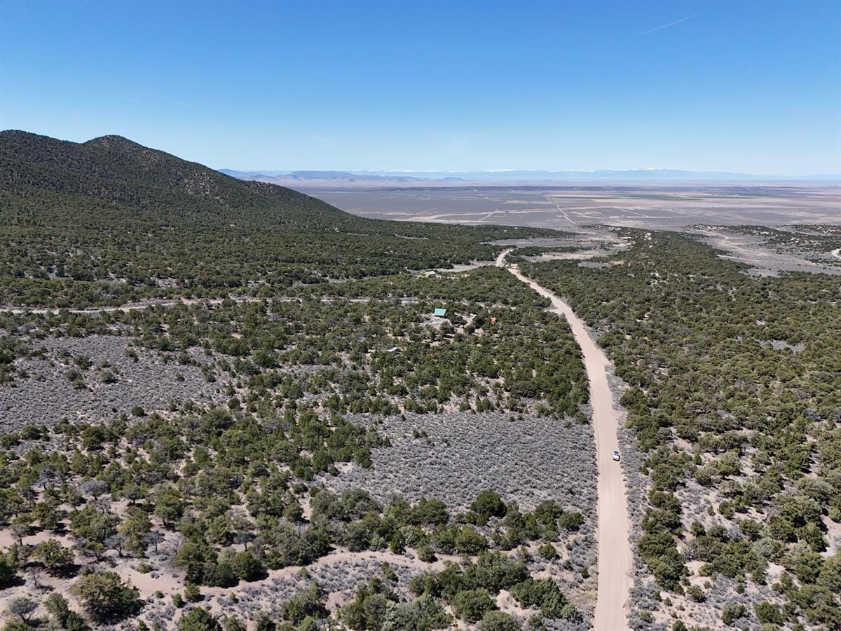
- Listing claims include direct access from county-maintained Pfotenhauer Road, confirmed legal access, Estate Residential zoning, no mandatory HOA dues, annual taxes of $212.48, and an elevation around 8,520–8,550 feet.
- The opportunity is real enough to study, but winter access, water, septic, heating fuel, wildfire planning, insurance, and road obligations should drive the next round of diligence.
Resilience Atlas provisional score: 46.5/100. This is an editorial decision-support score, not an appraisal, investment recommendation, legal conclusion, title review, safety guarantee, or buyer advice. The score follows the published methodology: https://mike-ghost.automatelabs.dev/resilience-atlas-property-scoring-methodology/
Important caveat: Resilience Atlas has not independently verified seller or LandFlip claims. Listing status, price, acreage, access, utilities, zoning, water, septic, restrictions, hazards, taxes, insurance, title, and financing terms should be verified directly with the seller, county offices, title professionals, surveyors, utility providers, insurers, lenders, and qualified local experts before anyone relies on them.
Listing snapshot
| Field | Detail |
|---|---|
| LandFlip ID | 418641 |
| LandFlip title | 5.27 Acres CO Mountains 279 Down |
| Source listing | https://www.landflip.com/land/418641 |
| Listed location | 2049 Pfotenhauer Rd, Fort Garland, CO 81133; Costilla County, Colorado |
| Acreage | 5.27 acres |
| Listed price | $18,999 USD |
| Seller/broker shown by LandFlip | Collin Pettet of Wild Domain, LLC |
| Resilience archetype | affordable high-elevation mountain basecamp |
| Suggested Ghost visibility | public |
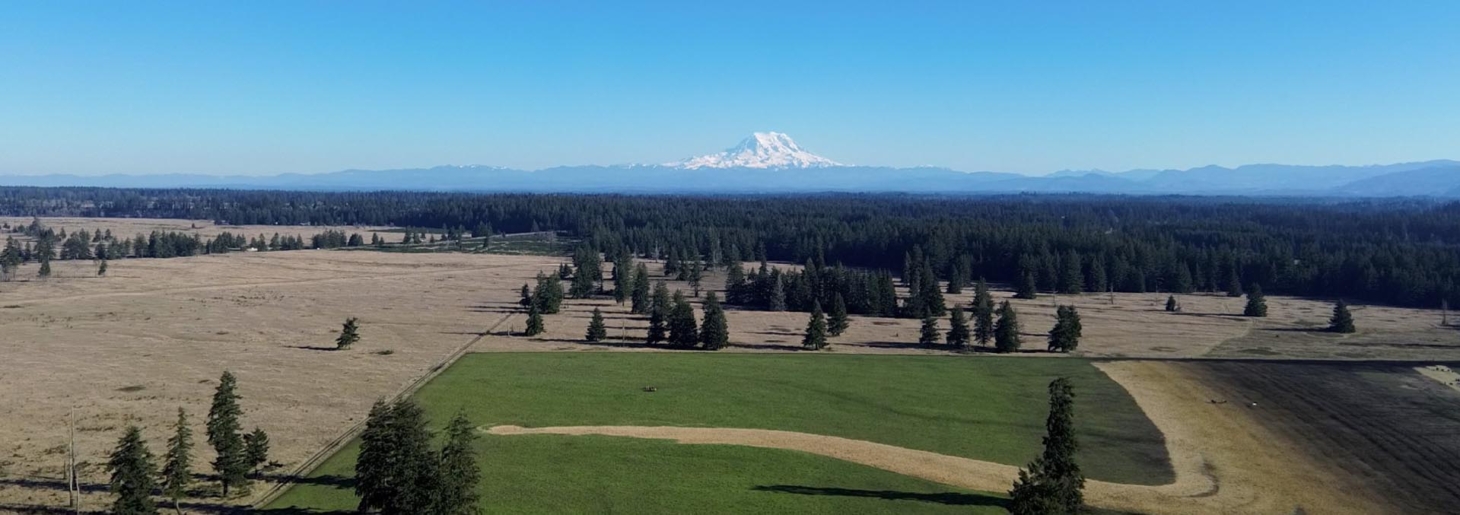
Gallery
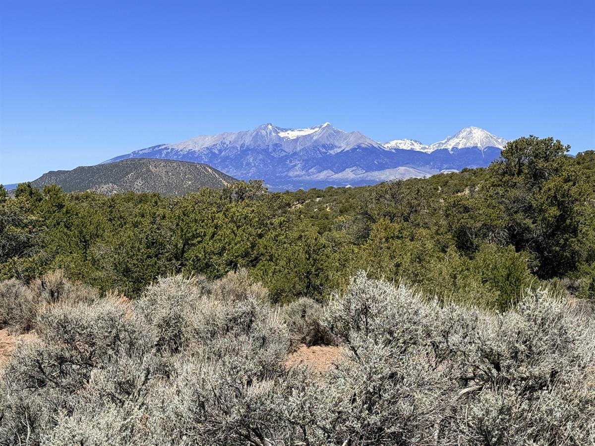
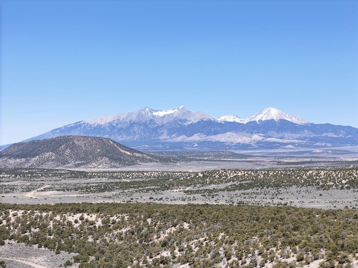
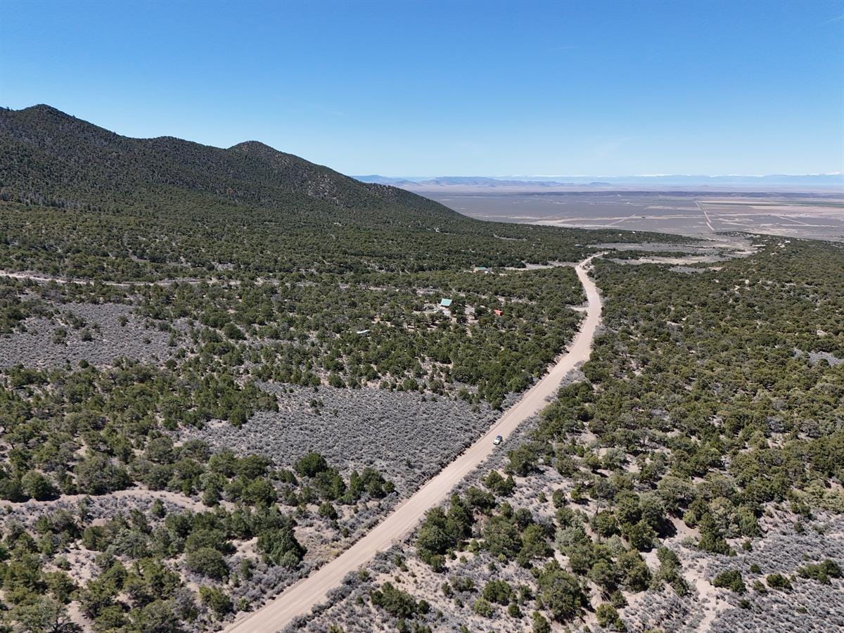
Images: LandFlip listing photos for LandFlip #418641, uploaded to Ghost for this report package. Retain LandFlip/seller source attribution during publication.
Video
Property-specific YouTube video verified by the image-package worker via oEmbed title “5.27 Acres in Fort Garland, Colorado | Mountain Land for Sale” by Wild Domain.
Scoring breakdown
| Category | Weight | Provisional score | Confidence | Weighted contribution | Note |
|---|---|---|---|---|---|
| Access and legal usability | 20% | 6/10 | Low | 12.0 | Listing claims legal access and county-maintained road; still needs parcel, road, and title confirmation. |
| Water, waste, and build feasibility | 20% | 3/10 | Low | 6.0 | No verified water/septic path in the dossier; high elevation increases build and winter-service complexity. |
| Infrastructure and communications | 15% | 4/10 | Low | 6.0 | No verified utility package; likely off-grid/logistics-heavy unless providers and build site are confirmed. |
| Hazard and insurability profile | 15% | 4/10 | Low | 6.0 | High elevation, snow, freeze, wildfire, and emergency access require specific review. |
| Land-use freedom and restrictions | 10% | 5/10 | Low | 5.0 | Listing claims Estate Residential zoning and no mandatory HOA dues; covenants and permitted uses require records review. |
| Resilience fit and operating practicality | 10% | 6/10 | Medium | 6.0 | Strong basecamp archetype if used seasonally and legal/physical access checks out. |
| Price/value context | 5% | 7/10 | Medium | 3.5 | Low listed price supports the case study, but could mask water/access/build costs. |
| Evidence quality / diligence completeness | 5% | 4/10 | Low | 2.0 | Useful listing detail and county verification path, but many critical facts remain seller claims. |
| Total | 100% | 46.5/100 | Conservative provisional score based on listing claims plus public-source context, not full buyer diligence. |
Deal-breaker flags are separate from the numeric score. A single unresolved deal-breaker — legal access, title, water, septic, road status, zoning conflict, insurance failure, or financing/title-transfer problem — can override a decent total score.
Strengths
- Low listed acquisition price for a mountain-retreat case study.
- Clear editorial archetype: small high-country basecamp rather than full homestead promise.
- Listing provides specific claims that can be verified or rejected: road, zoning, legal access, taxes, HOA, and subdivision identity.
- Costilla County Planning & Zoning resources create an obvious verification path.
Due-diligence considerations
- Confirm assessor parcel number and whether it matches Lot 2049, Block 126, Sangre de Cristo Ranches Unit L.
- Confirm Pfotenhauer Road status, maintenance responsibility, seasonal limits, and emergency access.
- Confirm well/cistern/hauling rules, septic feasibility, driveway requirements, and winter build constraints.
- Review covenants, greenbelt documents, POA/road obligations, taxes, special assessments, wildfire exposure, and insurance availability.
Buyer profile
Best fit for a patient buyer looking for a seasonal mountain basecamp or cabin candidate who is comfortable verifying high-elevation logistics before committing money. Poor fit for someone who needs immediate year-round occupancy, easy utilities, or low-friction construction.
Property analysis
The Colorado parcel is attractive because it does not try to be everything. Its value proposition is simple: a modestly priced mountain parcel with retreat potential. That simplicity should not be confused with certainty. A high-elevation site can be beautiful and still be hard to operate. The practical questions are not decorative: can a buyer legally access it in winter, get water without heroic expense, place a septic system, insure the intended use, and maintain access during snow and fire seasons? If those answers are documented, this could be one of the cleaner public examples in the set. If they remain assumed, the score should stay conservative.
Caveats before publication or reliance
- Re-check the LandFlip listing immediately before publication for active status, price, acreage, availability, seller copy, and images.
- Keep listing-derived facts framed as listing claims unless a parcel-specific public record or professional source verifies them.
- Do not present the Resilience Atlas score as a buying recommendation or market-value estimate.
- Retain LandFlip/seller image source attribution and the original listing link.
- Treat unresolved water, septic, title, legal access, road, utility, hazard, insurance, and financing questions as diligence items, not assumptions.
Sources and verification starting points
- https://www.landflip.com/land/418641
- https://www.costillacounty.gov/
- https://www.costillacounty.gov/planning-and-zoning/page/planning-zoning-resources
CTA
If this kind of property-intelligence brief is useful, join Resilience Atlas for more sourced rural-land reports, due-diligence frameworks, and practical resilience-property analysis. The goal is not to kill the dream. It is to make the dream survive contact with records, roads, water, weather, rules, and operating costs.
Ghost publishing notes
{
  "landflip_id": "418641",
  "title": "Colorado High-Country Basecamp: 5.27 Acres Near Fort Garland",
  "slug": "colorado-high-country-basecamp-5-27-acres-fort-garland",
  "visibility": "public",
  "status": "draft",
  "feature_image": "https://mike-ghost.automatelabs.dev/content/images/2026/05/418641-01-5-27-acres-co-mountains-279-down.jpg",
  "feature_image_alt": "Primary LandFlip listing photo for 5.27 Acres CO Mountains 279 Down, 5.27 Acres, 2049 Pfotenhauer Rd, Fort Garland, CO 81133, Costilla County, Colorado.",
  "tags": [
    "Property Reports",
    "Resilience Atlas",
    "Rural Land",
    "Land Due Diligence"
  ],
  "methodology_url": "https://mike-ghost.automatelabs.dev/resilience-atlas-property-scoring-methodology/",
  "source_listing_url": "https://www.landflip.com/land/418641",
  "provisional_score": 46.5,
  "required_before_publish": [
    "last-minute LandFlip listing recheck",
    "retain caveats",
    "retain image/source attribution"
  ]
}