Source image: Mossy Oak Properties / RealStack listing media.
Property Snapshot
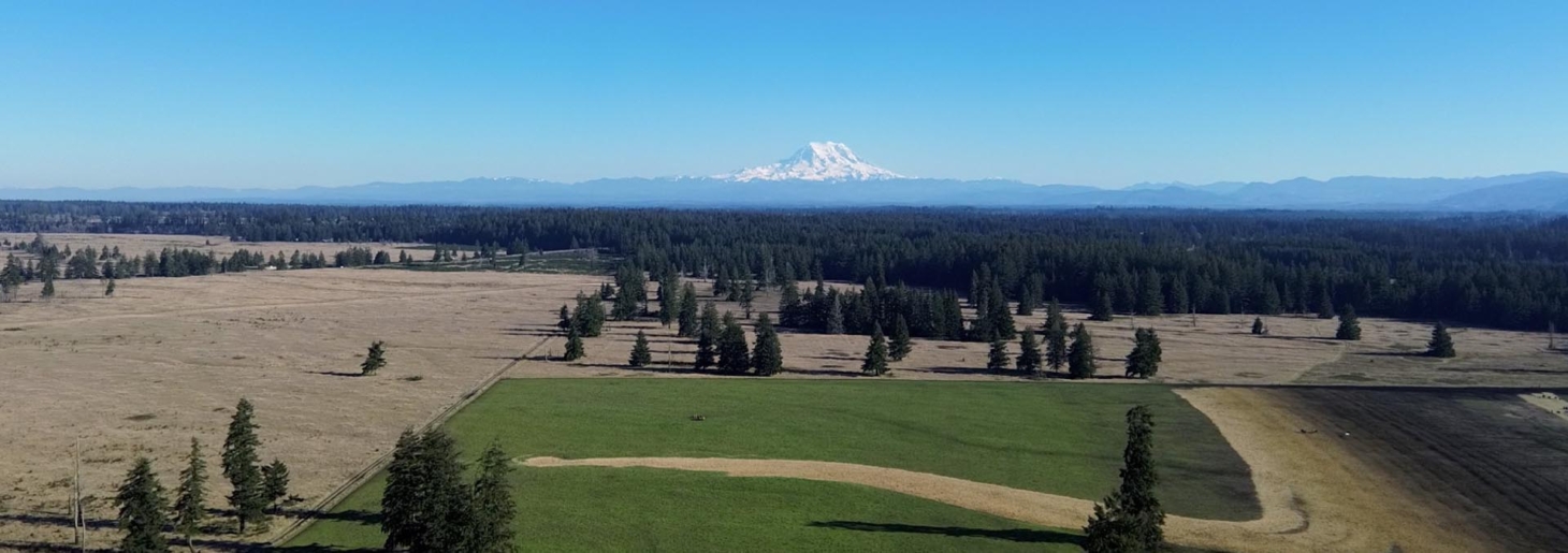
Moccasin Flats 700± Acre Waterfowl Farm
700± acres · Stoddard County, Missouri · near Dudley and Highway 51
🟡 Conditional Candidate · 64%
A rare large-acreage waterfowl and agricultural tract with strong water and habitat assets, balanced by major due-diligence questions around floodplain/wetland exposure, legal/buildability constraints, utilities, septic, and long-term operating costs.
Core Facts
- Price: $7,777,000; listing indicates $11,110 per acre.
- Land: 700± acres of lowland sporting, crop, wetland, water-control, and habitat ground.
- Property type: Hunting land, riverfront/recreational land, and agricultural-use property.
- Best fit: Established waterfowl/deer/turkey property, agricultural-habitat asset, or private sporting base with carefully verified buildability.
Resilience Read
- Water: The listing reports river/waterfront/stream access, water-control structures, high-volume irrigation wells, and Mingo Ditch context; domestic potable water is not confirmed.
- Infrastructure: Wells, storage, RV/boat storage, sheds, and blinds are listed, but power, septic, and structure condition are unresolved.
- Access: Paved highway frontage is listed and the coordinates map to MO 51; exact legal access and internal-road condition still need confirmation.
- Use potential: Strong for managed habitat, waterfowl, deer/turkey, and crop-based food production; residential or commercial lodging use remains a legal and infrastructure question.
Source: Mossy Oak Properties / Mozark Realty listing
Reviewed: May 22, 2026 · Coordinates: 36.801216, -90.196782
Property Media
Images are externally loaded from the original Mossy Oak / RealStack listing media for review. Rights and rehosting permissions are not confirmed.


Photo source: Mossy Oak Properties listing.
Listing Video
Executive Summary
Moccasin Flats is a 700± acre Stoddard County, Missouri sporting and agricultural property marketed around waterfowl habitat, crop production, water-control infrastructure, and location within the Southeast Missouri lowlands. The listing positions it near the regional waterfowl corridor between Mingo National Wildlife Refuge, Duck Creek Conservation Area, and Otter Slough Conservation Area, with highway frontage west of Highway 51 near Dudley.
For Resilience Atlas purposes, the property’s strongest signals are scale, water-control potential, agricultural use, and access. The listing reports high-volume irrigation wells, established blinds, precision water-control structures, river/stream/waterfront classifications, crops including beans, corn, rice, and other uses, plus storage and shed improvements.
The main caution is that water-rich lowland land can carry serious regulatory, flood, drainage, insurance, maintenance, and buildability complexity. The listing does not establish domestic power, potable water, septic, broadband, zoning, covenants, easements, drainage district obligations, or whether residential/lodge/commercial use is legally practical.
Initial Verdict:
Conditional Candidate. This is a strong sporting and land-management property on paper, but it should move forward only after a careful survey/title, county, floodplain/wetland, water-rights, utility, septic, insurance, and structure/equipment review.
Key Strengths
- Large 700± acre tract with meaningful privacy and landscape control.
- Listing-reported river/stream/waterfront context, water-control structures, and irrigation wells.
- Crop and habitat mix suitable for wildlife, managed wetland, and agricultural use.
- Paved highway frontage and proximity to Dudley, Dexter, and Poplar Bluff.
- Rich source media with aerial views of fields, water features, wetland edges, and land pattern.
Key Concerns
- Floodplain, wetland, drainage, levee, and water-control obligations are not yet verified.
- Potable water, septic, domestic power, and communications are unknown from the listing.
- Residential, lodge, commercial, RV, and event uses require zoning and permitting confirmation.
- Exact parcel boundaries, St. Francis River relationship, Mingo Ditch relationship, easements, and rights require survey/title review.
- Operating costs for pumps, water-control structures, levees, blinds, insurance, taxes, crop arrangements, and maintenance could be substantial.
Location Analysis
Regional Context
The property is listed west of Highway 51 near Dudley in Stoddard County, Missouri. Approximate routed distances from the listing coordinates place Dudley about 11.7 km / 7.3 miles away, Dexter about 24.7 km / 15.4 miles away, and Poplar Bluff about 21.5 km / 13.4 miles away.
This is Southeast Missouri lowland country: a practical fit for waterfowl habitat, crop ground, managed wetlands, and large recreational holdings, but also a region where drainage, floodplain, wetland, and water-management details can matter as much as acreage.
Access and Roads
The listing reports paved highway frontage, and map context places the coordinates along MO 51. That is a meaningful resilience advantage compared with remote landlocked tracts. Still, a buyer should confirm legal ingress/egress, driveway rights, internal farm-road condition, seasonal access during wet periods, and emergency-vehicle access.
Distance to Services
- Groceries/general supplies: Walmart Supercenter in Dexter is approximately 20.3 km / 12.6 miles away.
- Medical: Mercy Hospital Stoddard in Dexter is approximately 22.5 km / 14.0 miles away; Poplar Bluff Regional Medical Center - Westwood is approximately 26.6 km / 16.5 miles away.
- Fuel: A Poplar Bluff fuel stop in the map check was approximately 23.3 km / 14.5 miles away.
- Regional context: Sikeston is approximately 59.8 km / 37.1 miles away, and Cape Girardeau regional medical context is roughly 112.2 km / 69.7 miles away.
Land and Terrain
Acreage Usefulness
At 700± acres, Moccasin Flats is large enough to support multiple land uses at once: managed waterfowl units, crop fields, field-edge habitat, timber/wetland pockets, storage, access lanes, and privacy buffers. The media set suggests a strong field-and-water pattern rather than a steep or rocky rural parcel.
Soil and Growing Potential
The listing identifies beans, corn, rice, and other crops. That is a useful food-production and land-management signal, but public record work still needs to confirm soil types, FSA maps, tillable acreage, drainage class, crop leases, irrigation rights, and wetland or conservation limits.
Water Features
Water is the property’s central strength and central risk. The listing reports river, riverfront, stream, waterfront, high-volume irrigation wells, water-control structures, and proximity to Mingo Ditch. These details make the tract interesting for wildlife and production, but require verification of floodplain, wetlands, pumping permits, riparian rights, drainage districts, levee/ditch obligations, and flood-insurance implications.
Utilities and Infrastructure
Power
Domestic power service is not established in the listing evidence. Buyers should verify electric service, meters, phase/voltage, generator systems, pump power, provider, reliability, and extension costs.
Water
Irrigation wells are listed, and a well appears in the listed improvements. That does not automatically mean potable domestic water is available. Confirm well locations, permits, production rates, pump equipment, water quality, filtration needs, and whether any well can legally and practically serve a dwelling or lodge.
Septic and Waste
No septic system or domestic wastewater solution is confirmed. Before assuming residential, lodge, RV, or long-stay use, verify county health rules, perc suitability, existing permits, bathrooms, dump arrangements, and whether floodplain or high-water-table conditions constrain septic design.
Internet and Communications
Broadband and cellular service are unknown from the listing. The open terrain may be compatible with Starlink and radio planning, but that remains an assumption until field-tested. Check the FCC Broadband Map, WISPs, fiber/cable providers, cellular carrier signal on-site, and emergency-radio practicality.
Off-Grid and Resilience Potential
Solar Suitability
Large open fields could support ground-mounted solar, especially for a farm base, storage area, or pump-support system. Limiting issues include flood exposure, equipment siting, theft/weather protection, battery location, and integration with any existing grid or pump electrical systems.
Heating and Cooling
No residence is confirmed in the listing. If a cabin, lodge, or work base were pursued, it should use an efficient envelope, heat pump or propane backup, elevated/safe mechanical placement, and moisture/flood design appropriate to lowland conditions.
Food Production Potential
The crop claims and irrigation assets give the property better food-production potential than purely wooded recreational land. Verify tillable acreage, farm leases, soil maps, crop history, chemical history, irrigation legality, and whether garden/orchard/livestock areas would be practical outside wet or flood-prone zones.
Security and Privacy
The acreage provides substantial separation and control, but highway frontage and agricultural access mean it is not automatically hidden. Practical privacy depends on gate placement, internal road layout, visible structures, neighboring parcels, field openness, and seasonal vegetation.
Legal, Zoning, and Buildability
Zoning
Zoning and permitted uses were not established in the source evidence. Possible commercial, hunting, and recreational uses are listed, but residential dwelling, lodge, outfitting operation, event use, RV stays, multiple structures, rentals, or commercial activity must be confirmed with Stoddard County and qualified local counsel.
Permits and Restrictions
Priority checks include survey, title, exact parcels, legal access, easements, covenants, mineral/timber/water/riparian rights, wetland delineation, FEMA floodplain, drainage or levee district obligations, crop/hunting leases, water-control permits, well permits, and insurance availability.
Risk Assessment
Environmental Risks
The most important environmental risks are flooding, wetland regulation, drainage, levee/ditch obligations, erosion, pump/water-control failure, and extreme rain events. Drought is also relevant because crop and waterfowl management depend on reliable water operations.
Financial and Practical Cost Risks
The asking price and scale make this a serious operating property rather than a casual recreational tract. Costs may include taxes, insurance, flood insurance, drainage or levee assessments, pump maintenance, blind and road maintenance, crop arrangements, legal review, survey work, water-control repairs, and residential infrastructure.
Practical Risks
The property could be excellent for a buyer who wants a managed waterfowl and crop-habitat asset. It could be frustrating for a buyer expecting simple off-grid homesteading if buildability, septic, potable water, flood risk, or commercial-use permissions prove difficult.
Estimated Development Path
Phase 1: Due Diligence
Verify survey, legal access, parcel acreage, title, zoning, floodplain, wetlands, drainage district status, levee/ditch obligations, St. Francis River and Mingo Ditch boundary relationships, water rights, well permits, utility service, septic feasibility, insurance, crop/hunting leases, included equipment, and structure condition.
Phase 2: Basic Use
After purchase, stabilize access, inspect and document pumps/wells/water-control features, inventory blinds and structures, test communications, establish a secure storage/work base, and create a maintenance calendar for water and road systems.
Phase 3: Resilient Buildout
A longer-term resilient buildout could include an elevated cabin or lodge if legally permitted, solar plus battery for critical systems, backup generator, secure equipment storage, field-tested communications, garden/orchard areas on suitable ground, rainwater backup, and a flood/emergency operations plan.
Property Scorecard
This public scorecard uses the required Resilience Atlas 12-category framework. Percentages are an initial initial resilience assessment, not a substitute for survey, title, county, utility, insurance, floodplain, and on-site verification.
Major waterfowl and irrigation assets are claimed, including water-control structures, high-volume irrigation wells, St. Francis River frontage, and Mingo Ditch context; potable domestic water and water rights still need verification.
The 700± acre scale and managed habitat support real separation from neighbors, but Highway 51 frontage and agricultural operations mean it is not a hidden deep-woods retreat.
Cropland, irrigated fields, and large acreage create strong production potential, while soil performance, crop arrangements, chemical history, and flood timing still need on-site and county verification.
Existing wells, water-control features, blinds, structures, roads, and agricultural systems give the property a useful starting base, but residential power, potable water, septic, and building services remain unresolved.
Solar, generator backup, elevated structures, and water-system resilience may be feasible, but lowland flooding, tree cover, legal limits, and lack of confirmed domestic utilities keep this at a conditional level.
The Highway 51/Dudley-area setting improves the odds of cellular or fixed wireless service compared with deep remote land, but carrier coverage, Starlink siting, and emergency-radio performance must be field-tested.
Scale, water, fields, levees, ditches, and internal access patterns provide useful management control, but flat lowland terrain and highway exposure limit natural concealment and require practical access planning.
Water abundance is a major advantage for habitat and agriculture, yet the same lowland river-and-ditch setting raises floodplain, wetland, drainage, insurance, and extreme-weather due-diligence concerns.
The property could support food, waterfowl, crop, solar-backup, storage, and retreat functions, but it needs confirmed legal residential use, reliable utilities, septic, and operating systems before it becomes self-sufficient.
Reported Highway 51 access is a strength, but legal ingress, zoning, floodplain/wetland limits, septic feasibility, building permissions, easements, and insurance remain the biggest practical gating issues.
The public property scorecard totals 62/100 across customer-facing land criteria, reflecting exceptional water, acreage, habitat, and working-land value balanced against unresolved buildability, floodplain, utility, communications, and legal-use questions.
Final Recommendation
🟡 Conditional Candidate
Moccasin Flats deserves deeper due diligence because the property combines scale, water, crop potential, access, and habitat in a way that few listings do. It is most compelling as a serious sporting/agricultural land-management asset with possible resilience value, not as a simple ready-made homestead.
The property should not be treated as a plug-and-play residential or commercial retreat until the legal, floodplain, wetland, water, septic, utility, insurance, access, and operating-cost questions are resolved.
Rating context: Candidate levels reflect how well the property fits practical Resilience Atlas criteria after weighing infrastructure, water, access, buildability, communications, risk, and unresolved due diligence.
Questions to Ask Before Moving Forward
- What exact parcels are included, and does the deed/survey confirm 700± acres?
- Is legal access confirmed from Highway 51 or another public road?
- What are the exact boundary relationships with the St. Francis River and Mingo Ditch?
- How much acreage is in FEMA floodplain, mapped wetland, drainage district, levee district, or conservation restriction area?
- What water-control structures exist, who maintains them, and are all permits current?
- How many irrigation wells exist, what are the production rates, and are they permitted for current use?
- Is any well potable or suitable for domestic use after testing?
- What grid power service exists for pumps, storage, or structures?
- Is there any septic system, permitted bathroom, or legal RV sanitation arrangement?
- Are sheds, RV/boat storage, pumps, tanks, blinds, and equipment included in the sale?
- Are crop leases, hunting leases, guide rights, or equipment exclusions in place?
- What zoning and permitted uses apply to residential, lodge, commercial, RV, or event use?
- Are mineral, timber, water, and riparian rights included?
- Which cellular providers work on-site, and is Starlink, WISP, fiber, or fixed wireless available?
- What are the realistic annual costs for taxes, insurance, flood insurance, drainage/levee assessments, roads, pumps, and water-control maintenance?
Source and Due-Diligence Starting Points
- Original Mossy Oak Properties listing
- Mossy Oak / RealStack brochure PDF
- Stoddard County property, recorder, zoning, health department, and emergency-management offices
- FEMA Flood Map Service Center, USDA Web Soil Survey, FCC Broadband Map, and field tests for utilities and communications