A Resilience Atlas Property Intelligence Report based on the Mossy Oak Properties source listing and supporting extraction work completed May 22, 2026. Listing claims are treated as unverified unless specifically noted.
Property Snapshot
Lake Cocodrie Wildlife and Game Preserve
3,473± acres / about 1,405.5 hectares · Rapides Parish, Louisiana source listing · Lake Cocodrie / central Louisiana context requires boundary verification
🟡 Conditional Candidate · 64/120
A rare water-rich Louisiana preserve with exceptional recreation, privacy, and conservation story value — but it needs unusually careful parcel-boundary, wetlands, floodplain, access, utilities, and buildability due diligence before anyone treats it as a resilient retreat or camp-development site.
Core Facts
- Price: $6,907,797; source-listed at $1,989 per acre.
- Land: 3,473± acres / about 1,405.5 hectares of source-described contiguous recreational land dominated by backwater, cypress, tupelo, wetlands, lake, bayou, and slough habitat.
- Property type: Recreational land and hunting land.
- Best fit: Conservation-minded recreational preserve, waterfowl/fishing property, private hunting club, or carefully permitted lakefront camp/lodge concept.
Resilience Read
- Water: Surface-water identity is the central strength, with Lake Cocodrie, bayous, sloughs, drainages, and a fishery; potable water and legal/buildable water use are unknown.
- Infrastructure: Existing wells, septic, power, cabins, docks, roads, blinds, boat launches, and structures are not stated by the listing.
- Access: The listing says the tract is just off I-49 between Forest Hill and Ville Platte, but exact legal access, driveway/boat access, and emergency access are unresolved.
- Use potential: Strong for fishing, waterfowl, wildlife viewing, paddling, conservation, and controlled recreation; uncertain for residential homesteading or conventional building until uplands and permits are confirmed.
Source: Mossy Oak Properties listing
Reviewed: May 22, 2026 · Coordinates: listing coordinate 32.449046, -93.69861 appears inconsistent with Lake Cocodrie locator-map context and should not be treated as authoritative.
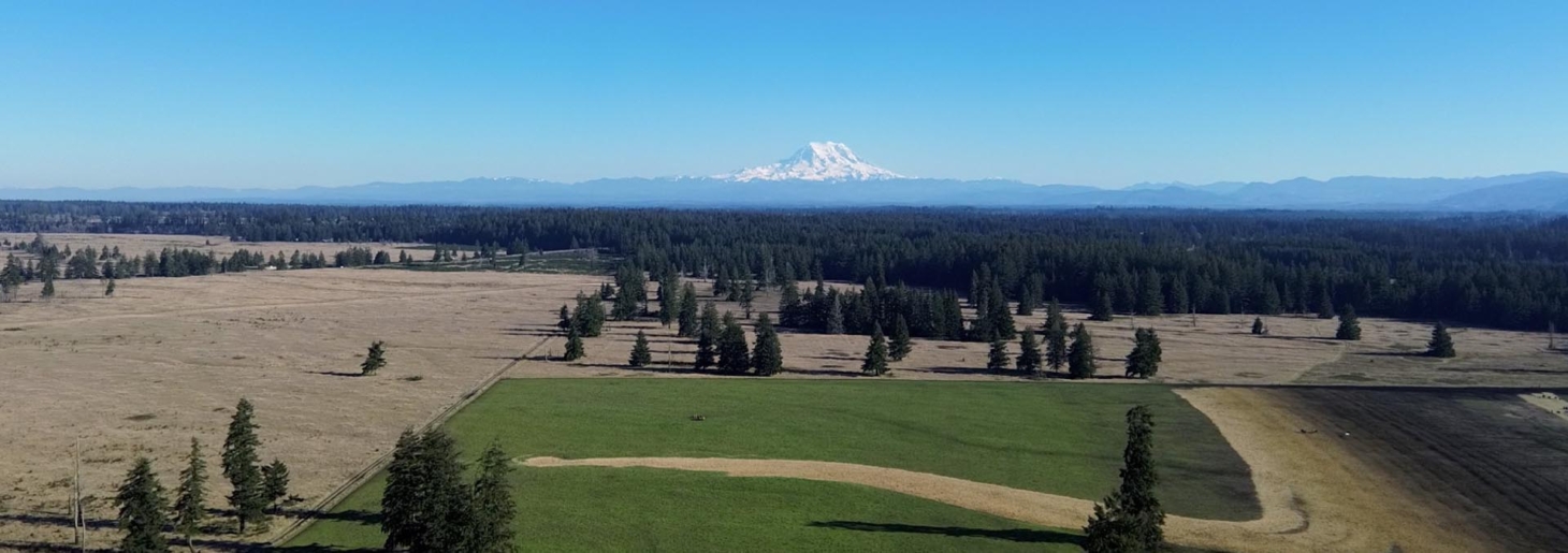
Property Media
Selected property-focused listing media. Only four property images were available from the source listing, so the gallery intentionally avoids unrelated nearby-property images.


Image source: Mossy Oak Properties / RealStack listing media. External listing images are used for draft review; reuse rights should be confirmed before long-term publication strategy.
Listing Video
Lake Cocodrie source video noted
The YouTube embed did not render reliably in this Ghost/browser environment, so this report does not present a black or broken player as if it were playable. The listing video remains useful as a source reference, but it should be opened separately for due diligence.
Executive Summary
Lake Cocodrie Wildlife and Game Preserve is a large Louisiana recreational tract source-listed at 3,473± acres / about 1,405.5 hectares, positioned around a cypress-and-tupelo backwater landscape with fishing, waterfowl, boating, and conservation appeal. For Resilience Atlas, it is interesting less as a conventional homestead and more as a water-rich preserve with scale, privacy, ecological value, and a strong visual story.
The strengths are obvious: water, habitat, scale, seclusion, fishing, duck-hunting narrative, and a rare cypress-wetland identity. The listing describes year-round freshwater fishing, private controlled duck hunting, bayou/canoe/kayak use, wildlife viewing, and possible conservation-easement or carbon-credit upside tied to wetlands, timber, and hydrology.
The caution is equally important. The evidence pack flags a material location inconsistency: the listing coordinate and ZIP appear to point far away from the Lake Cocodrie locator-map context. Existing potable water, septic, power, communications, structures, internal roads, legal access, floodplain, jurisdictional wetlands, and buildable uplands are all unknown. This is a compelling report candidate, but it is not a turnkey resilient-living property based on the evidence available.
Initial Verdict:
Conditional candidate for a conservation/recreation buyer or hunting/fishing group, with strong story and water value but major unresolved due-diligence questions around exact parcel location, access, hydrology, buildability, and utilities.
Key Strengths
- Large 3,473± acre / about 1,405.5-hectare scale with a source-listed contiguous ownership story.
- Strong water identity: Lake Cocodrie, bayous, sloughs, three upland drainages, and year-round fishery claims.
- High privacy and seclusion potential from large acreage, wetland landscape, and backwater setting.
- Excellent wildlife/recreation narrative, including duck hunting, fishing, boating, paddling, frogs, and wildlife viewing.
- Conservation and habitat-preservation story is explicit in the listing and fits Resilience Atlas readers interested in land stewardship.
Key Concerns
- Displayed coordinate and ZIP appear inconsistent with the Lake Cocodrie locator-map context; broker/county GIS confirmation is essential.
- Existing well, septic, grid power, docks, cabins, boat launches, blinds, roads, and other infrastructure are not documented in the listing.
- Wetlands, floodplain, hydrology, seasonal water levels, and buildable upland acreage could control what can realistically be built.
- Legal access, public/private road rights, navigable-water rights, easements, leases, and exclusive hunting/fishing rights are not confirmed.
- Communications, emergency response, insurance, zoning, and permitting remain major unknowns for any retreat or lodge concept.
Location Analysis
Regional Context
The listing places the property in Rapides Parish, Louisiana, with a narrative that points to the Lake Cocodrie / central Louisiana area between Forest Hill and Ville Platte, accessible from Alexandria and Lafayette via I-49. This is a waterfowl, fishery, wetland, and bayou-style context rather than a dry upland farm or ready rural residence.
Because the displayed listing coordinate appears inconsistent with the locator-map area, the safest public framing is regional rather than parcel-specific until the broker supplies a survey, legal description, parcel IDs, or GIS boundary. The evidence pack estimates distances from the OSM Cocodrie Lake center, not from a confirmed property gate.
Access and Roads
The source says the property is just off I-49 between Forest Hill and Ville Platte and accessible from Alexandria and Lafayette. That suggests workable regional access, but the property-level questions are still open: legal access route, public or private road status, easements, gate location, boat access, internal travel, wet-weather usability, and emergency vehicle access.
Distance to Services
- Forest Hill: approximately 34.5 km / 21.4 miles driving from the OSM Cocodrie Lake center; about 40 minutes.
- Ville Platte: approximately 39.9 km / 24.8 miles driving from the OSM Cocodrie Lake center; about 45 minutes.
- Alexandria: approximately 54.1 km / 33.6 miles driving from the OSM Cocodrie Lake center; about 49 minutes.
- Lafayette: approximately 117.4 km / 73.0 miles driving from the OSM Cocodrie Lake center; about 90 minutes.
- Mapped fuel: one OSM Exxon point appeared about 11.3 km / 7.0 miles straight-line from the OSM lake center; road distance and suitability are unverified.
- Mapped grocery context: Walmart Neighborhood Market in Pineville appeared about 40.5 km / 25.2 miles straight-line from the OSM lake center; road distance likely differs.
- Mapped medical context: the nearest OSM hospital result found in the evidence pack was about 31.9 km / 19.8 miles straight-line, but emergency-care suitability was not confirmed.
Land and Terrain
Acreage Usefulness
The acreage is massive, but usefulness depends on land composition. The listing emphasizes water, wetlands, cypress, tupelo, sloughs, bayous, and lakefront potential rather than open pasture, dry fields, or ready build sites. That makes it highly useful for habitat, recreation, conservation, and water-based retreat planning, but less certain for conventional homestead development.
Soil and Growing Potential
No soil map, pasture, cultivated acreage, garden area, orchard potential, or dry upland acreage was verified in the evidence pack. A buyer should obtain NRCS/soil data, wetland delineation, hydrology review, floodplain maps, and on-site soil testing before assuming septic suitability, gardens, orchards, roadbeds, or structural foundations.
Water Features
Water is the property’s defining feature. The source describes Lake Cocodrie, waterways, sloughs, bayous, three upland drainages feeding the fishery, and habitat for largemouth bass, white perch, bream, catfish, and frogs. The key diligence questions are legal water rights, seasonal water depth, flood behavior, navigability/public access, water-control infrastructure, and whether any dry, buildable areas exist where buyers would want them.
Utilities and Infrastructure
Power
No grid power, meter, nearby powerline, generator, solar system, or utility-extension detail is stated in the source listing. Any lodge, camp, or residential plan should begin with direct utility-provider confirmation and realistic extension or off-grid cost estimates.
Water
The listing’s water story is surface-water and habitat-driven, not domestic water. No well, potable water source, pump, treatment system, or water-storage setup is documented. Domestic water would require well feasibility, water-quality testing, rainwater strategy, filtration, and legal review.
Septic and Waste
Existing septic is unknown. Wetland and floodplain conditions may significantly limit conventional septic options, so a buyer should confirm perc potential, permitted systems, composting/alternative-system rules, and any camp/lodge wastewater requirements before planning improvements.
Internet and Communications
The listing does not document fiber, cable, fixed wireless, cellular coverage, Starlink practicality, or radio conditions. For a remote wetland preserve, communications should be tested on site with major carriers, Starlink obstruction checks, and backup radio planning for emergency use.
Off-Grid and Resilience Potential
Solar Suitability
No installed solar or off-grid power system is listed. Solar may be possible on confirmed upland clearings, docks, camps, or cleared service areas, but heavy tree cover, wet ground, permitting, shade, and storm exposure could make siting more complex than on open pastureland.
Heating and Cooling
Louisiana heat, humidity, insects, storm risk, and wetland conditions would shape any livable buildout. A resilient camp or lodge would likely require efficient cooling, dehumidification, screened/raised construction, backup power, flood-aware siting, and careful insurance review.
Food Production Potential
The strongest food-related value is fish and game, assuming legal rights and sustainability are confirmed. Garden, orchard, livestock, greenhouse, and pasture potential are not demonstrated by the listing and would depend on dry upland soils, water management, access, and permitting.
Security and Privacy
Large acreage, water barriers, cypress/tupelo cover, and limited visibility can support privacy and low-impact recreation. The practical limitation is that wetland properties often have complex access, public-water, navigability, lease, easement, and emergency-response questions that matter more than simple seclusion.
Legal, Zoning, and Buildability
Zoning
Zoning and land-use rules were not verified. Confirm the responsible parish/jurisdiction after the parcel boundary is clarified, then check residential use, camps, lodges, hunting-club operations, commercial retreat use, RV stays, tiny homes, mobile homes, docks, piers, boat launches, utilities, and short-term rental rules.
Permits and Restrictions
The listing’s claim of extensive potential lakefront development is a major due-diligence item, not a ready conclusion. Wetlands, floodplain, floodway, navigable waters, conservation restrictions, timber rights, mineral rights, carbon rights, easements, leases, title exceptions, environmental permits, and insurance could materially shape what is legal and practical.
Risk Assessment
Environmental Risks
The same water-rich features that make the property special also create the main risks: flooding, jurisdictional wetlands, seasonal access, unstable or saturated soils, erosion, storms, heat, humidity, insects, and potential constraints on clearing or building. FEMA, wetlands, hydrology, and on-site engineering review should come before any development assumptions.
Financial / Practical Cost Risks
The asking price is $6,907,797, and the practical cost risk is not just the purchase price. A buyer may need substantial legal, survey, GIS, hydrology, wetlands, engineering, road/access, utility, insurance, dock/boat, wildlife-management, and permitting budgets before the property can support reliable private use.
Practical Risks
The biggest practical risk is mistaking a remarkable recreational preserve for a turnkey retreat. Exact boundary, access, buildable uplands, utilities, domestic water, septic, communications, emergency access, and permitted development all remain unresolved.
Estimated Development Path
Phase 1: Due Diligence
Before purchase, confirm parcel IDs, legal description, survey, GIS boundary, coordinate discrepancy, title, easements, road or water access, hunting/fishing rights, leases, zoning, wetlands, floodplain, hydrology, buildable uplands, well/septic feasibility, power availability, communications, insurance, taxes, conservation/carbon rights, mineral/timber rights, and permitting.
Phase 2: Basic Use
If legal access and permitted uses check out, early use could focus on controlled recreation: gated access, safe boat/canoe access, signage, boundary marking, emergency communications tests, habitat assessment, water-level observations, basic security, and temporary low-impact use where legally allowed.
Phase 3: Resilient Buildout
A long-term buildout might include a legally permitted raised camp, lodge, dock/boat infrastructure, solar plus generator backup, water storage and treatment, communications equipment, managed access routes, wildlife/habitat stewardship, conservation planning, and flood-aware insurance and emergency planning.
Property Scorecard
The lake, bayous, sloughs, upland drainages, and fishery give the tract a strong surface-water identity, but potable water, flood behavior, legal water use, and build-site drainage are not verified.
At 3,473± acres / about 1,405.5 hectares in a wetland/backwater setting, the property has exceptional scale and natural separation; public-water, lease, and easement rights still need confirmation.
Fishing, foraging, waterfowl, and wildlife value are strong, but the listing does not show pasture, gardens, orchards, dry upland soils, or domestic water systems for homestead food production.
The listing does not document existing cabins, docks, boat launches, blinds, wells, septic, power, internal roads, or utilities, so the tract should be treated as minimally improved until proven otherwise.
Large acreage, timber, water access, and privacy help the off-grid case, but wetland terrain, unknown buildable uplands, unknown utilities, and no listed solar systems make implementation uncertain.
No fiber, broadband, cellular, fixed-wireless, Starlink, or emergency-radio performance is stated, and the wooded wetland setting could complicate reliable communications.
The backwater landscape, large acreage, and natural water/forest barriers support privacy and site control, but low wet terrain, uncertain access, and emergency response logistics limit practicality.
Water abundance and habitat value are real strengths, while floodplain, wetlands, hurricanes, heat, humidity, insects, seasonal access, and insurance exposure remain major unresolved risks.
The property could support a recreation, conservation, hunting, fishing, and retreat model, but a full self-sufficient homestead would depend on confirmed dry build sites, potable water, septic, access, and communications.
The listing has a memorable Louisiana cypress, tupelo, waterfowl, fishery, and conservation story with strong visuals and enough scale to justify a flagship Resilience Atlas feature.
Ancient cypress, quiet water, canoe routes, private fishing, and a hidden-preserve feel make the tract highly compelling for readers drawn to wild, water-rich land.
Regional I-49 access is promising, but exact parcel boundary, coordinates, legal road or water access, wetlands, floodplain, zoning, and lakefront-development permissions are all unresolved.
Overall score: 64/120. Lake Cocodrie is a memorable water-and-wildlife property with exceptional scale and privacy, but its readiness is held back by unverified coordinates, access, utilities, buildable uplands, wetlands/floodplain, and communications.
Final Recommendation
🟡 Conditional Candidate — viable only if key unknowns resolve
Lake Cocodrie Wildlife and Game Preserve is a strong Resilience Atlas story property and a potentially exceptional conservation/recreation holding. Its scale, water, wildlife, cypress/tupelo setting, fishing, waterfowl narrative, and visual character make it memorable and report-worthy.
It should be treated as conditional rather than strong because the unknowns are material. The coordinate inconsistency alone requires broker and county confirmation, and the development claims depend heavily on wetlands, floodplain, legal access, buildable uplands, utilities, domestic water, septic, insurance, and permitting. For a buyer seeking wild land, habitat, and controlled recreation, it deserves deeper investigation. For a buyer seeking a straightforward homestead or ready retreat, it is not yet proven.
Rating context: Candidate levels reflect how well the property fits Resilience Atlas criteria after weighing infrastructure, water, access, buildability, communications, risk, and unresolved due diligence.
Questions to Ask Before Moving Forward
- What are the exact parcel numbers, legal description, survey, and GIS boundaries?
- Why do the listing coordinate and ZIP appear inconsistent with the Lake Cocodrie locator-map context?
- Is the full 3,473± acre / about 1,405.5-hectare tract contiguous and under the same ownership?
- What is the legal access route, and is access by public road, private road, easement, water, or a combination?
- Are there existing camps, cabins, docks, blinds, boat launches, internal roads, levees, water-control structures, wells, septic systems, or power service?
- How much acreage is open water, jurisdictional wetland, floodplain/floodway, timbered swamp, and buildable upland?
- Are camps, lodges, docks, waterfront retreats, or commercial hunting-club uses legally permitted?
- What parish or jurisdiction controls zoning, permitting, wetlands, floodplain, and building approvals?
- Are hunting, fishing, boating, and water access private and exclusive, or affected by public/navigable-water rights?
- Are mineral, timber, conservation, and carbon rights included or reserved?
- What are annual taxes, insurance requirements, flood-insurance implications, and liability concerns?
- Which cellular, broadband, satellite, and radio options work on site?
- What is realistic emergency response time to the main use areas by road and/or water?