Property Snapshot
Strong River 96± Acre Retreat
96± acres · Simpson County, Mississippi · near Mendenhall
🟡 Conditional Candidate · 82/120
A river-fronted timber and recreation tract with strong retreat potential, but utilities, floodplain exposure, septic/water feasibility, and zoning need verification before it can be treated as a resilient homestead candidate.
Core Facts
- Price: $325,000
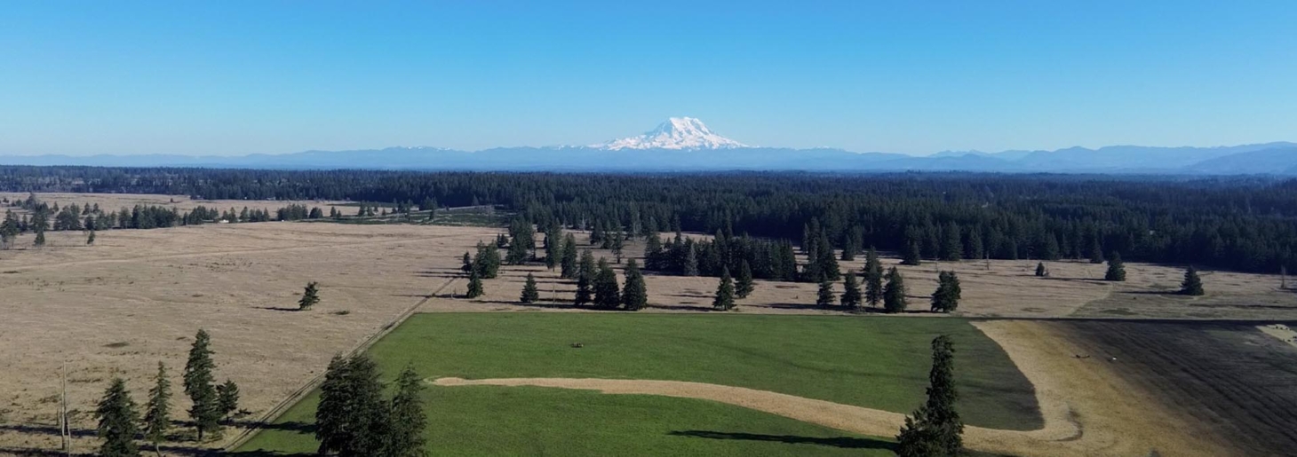
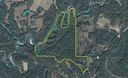
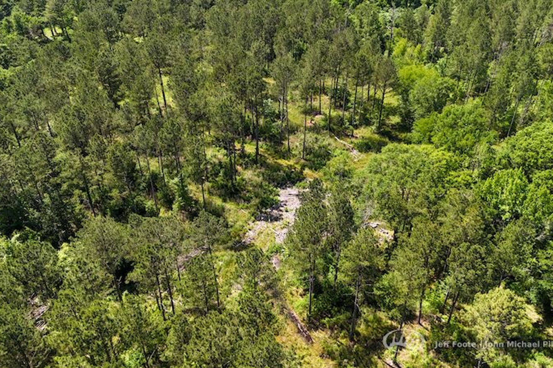
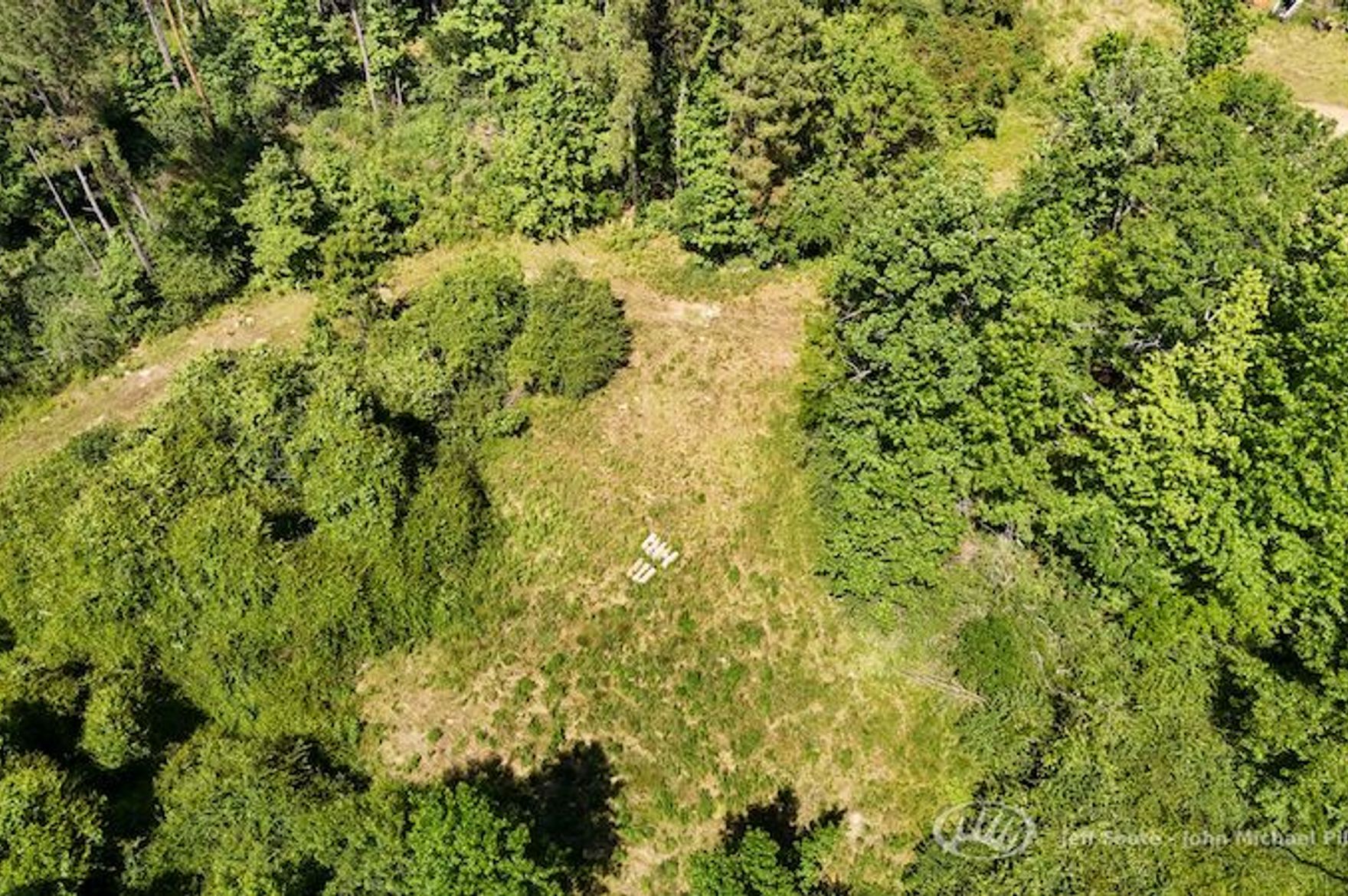
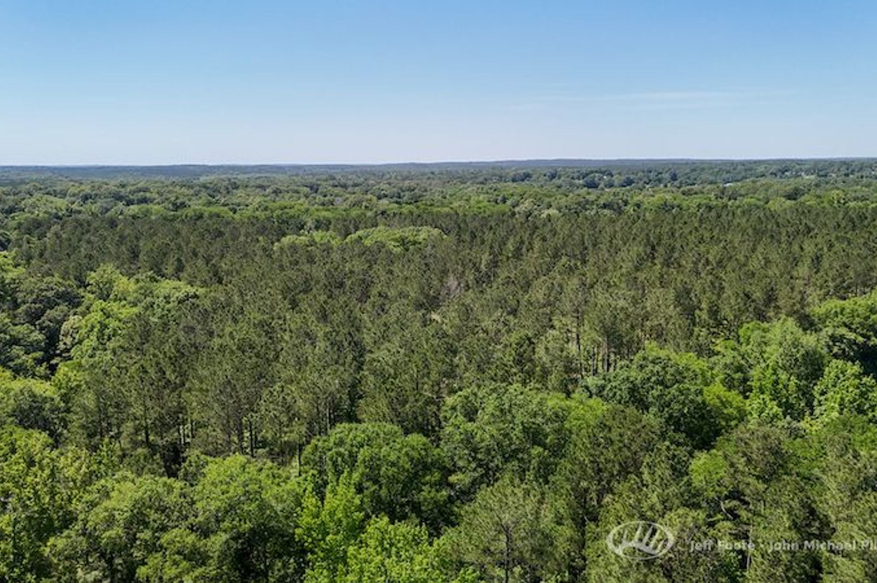
- Land: 96± acres with Strong River frontage, mixed hardwood/pine timber, internal roads/trails, and food plot areas.
- Property type: Recreational timber and riverfront land with potential camp or homesite clearing.
- Best fit: Weekend retreat, hunting base, resilient cabin site, or longer-term land stewardship project after due diligence.
Resilience Read
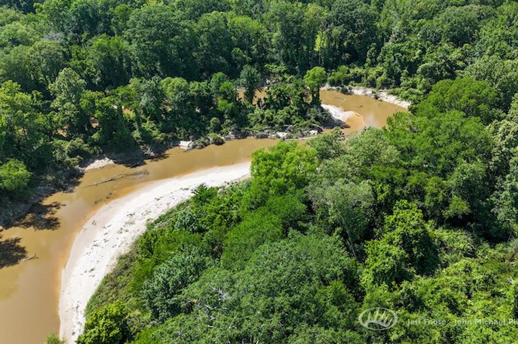
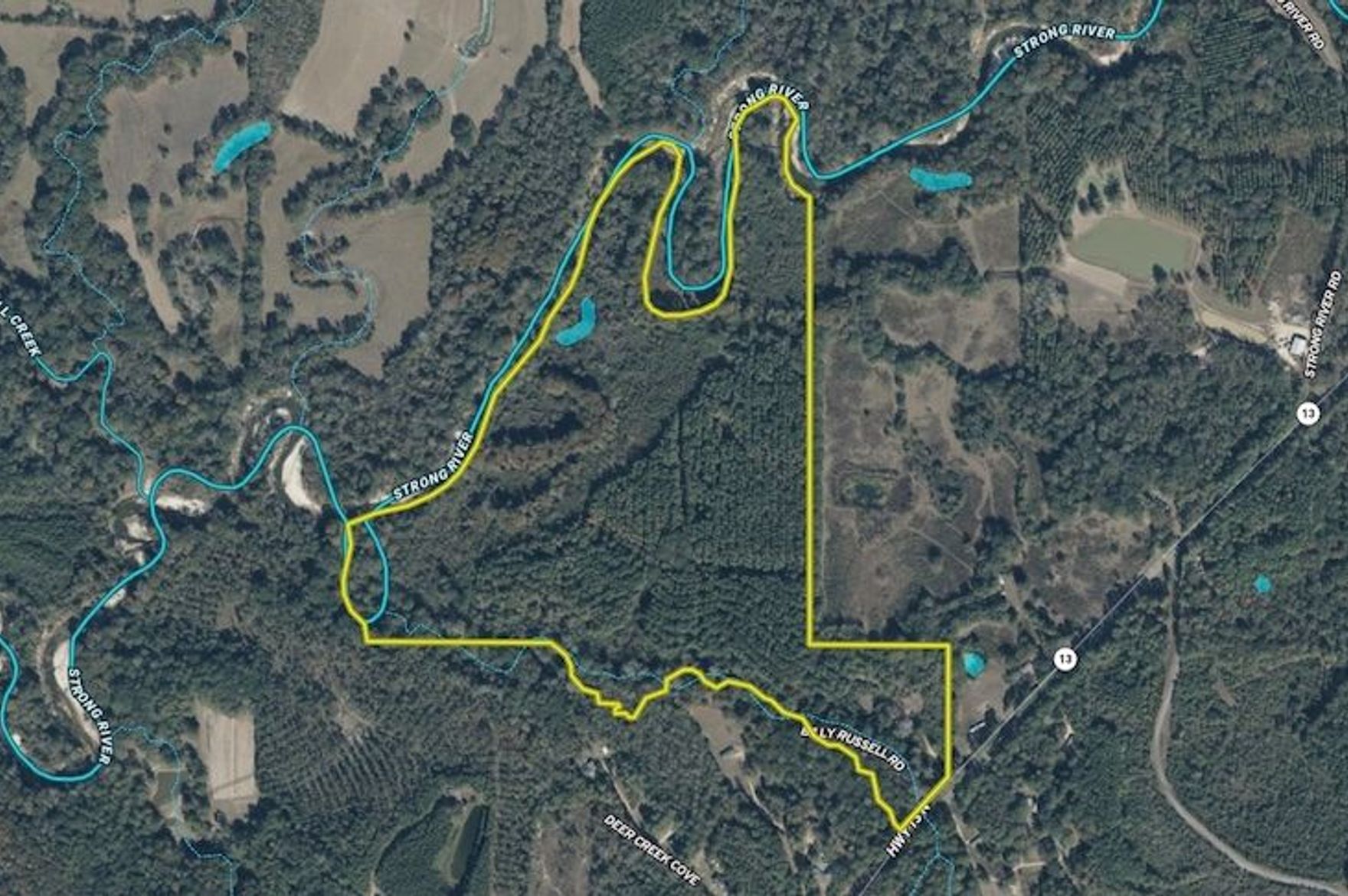
- Water: The listing claims about 1.6 km / 1 mile of Strong River frontage; domestic water rights, floodplain limits, and well feasibility remain unverified.
- Infrastructure: Gated entrance, gravel access road, and internal trail system are meaningful first-step improvements.
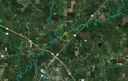
- Access: Direct Highway 13 access with Highway 49 nearby gives practical year-round reach while preserving some interior privacy.
- Use potential: Timber, wildlife habitat, food plots, and a private clearing support a retreat or camp concept more than a turnkey homestead.
Source: Whitetail Properties listing
Reviewed: May 19, 2026 · Coordinates: 31.9953, -89.8576
Property Media
Listing media reviewed for property-focused, landscape-oriented hero/gallery use. No people-primary or face-dominant images were selected.


Media source: original Whitetail Properties listing. Images are used here for internal Resilience Atlas review and property-intelligence context.
Executive Summary
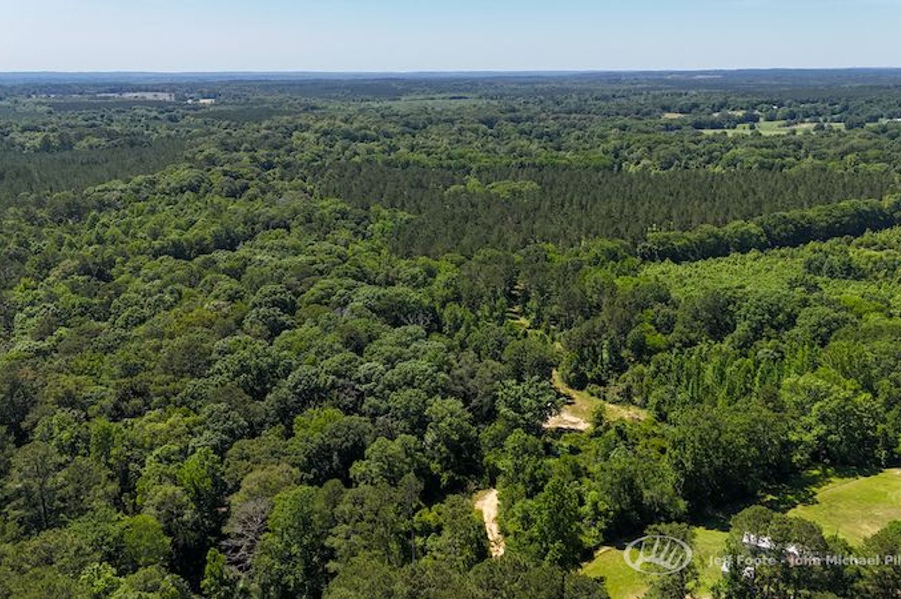
This 96± acre Simpson County tract stands out because it combines meaningful acreage, river frontage, existing access, and a practical location near Mendenhall. The listing claims approximately 1.6 km / 1 mile of Strong River frontage, a gated entrance from Highway 13, a gravel road into the tract, and an internal road/trail network that reaches through the property and down toward the river.
For Resilience Atlas purposes, the property is interesting because it is not just vacant timber. It has a recognizable water feature, useful wildlife and food-plot infrastructure, a likely camp/homesite clearing, and enough acreage to support privacy, woodlot management, hunting, recreation, and a staged retreat buildout.
The main caution is that this is still a due-diligence-heavy land candidate. The listing does not confirm grid power, well, septic, broadband, zoning, survey status, wetlands, or floodplain boundaries. Strong River frontage is a major asset, but it also means floodplain and build-site placement must be checked carefully before any permanent cabin or residential plan.
Initial Verdict:
Worth deeper investigation as a river-fronted retreat and resilience-land candidate, provided floodplain, utilities, legal buildability, and domestic water questions are resolved before purchase.
Key Strengths
- Borders the Strong River
- Excellent deer and turkey hunting
- Gated entrance directly off Highway 13
- Approximately 2.4 km / 1.5 miles from Highway 49
- Approximately 3.2 km / 2 miles from Mendenhall
- Established gravel entrance road
- Internal road and trail system throughout the property
- Mixed hardwood and pine timber stands
- Several food plot areas
- Private clearing for potential camp or homesite
Key Concerns
- Floodplain and riparian restrictions are not verified despite the extensive river frontage.
- No confirmed well, septic, power service, broadband, or existing dwelling is listed.
- Mississippi heat, humidity, storms, insects, and river-bottom drainage can raise maintenance demands.
- Highway 13 access is practical but means the property may not feel deeply remote near the entrance.
- Legal buildability, zoning, survey boundaries, and insurance availability must be confirmed locally.
Location Analysis
Regional Context
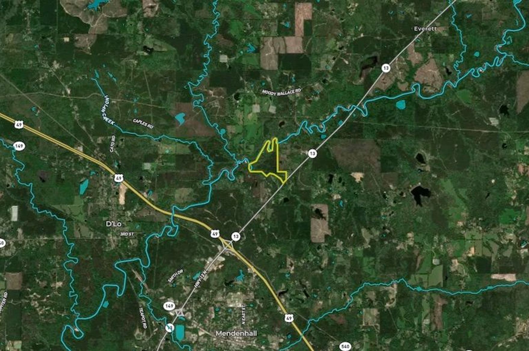
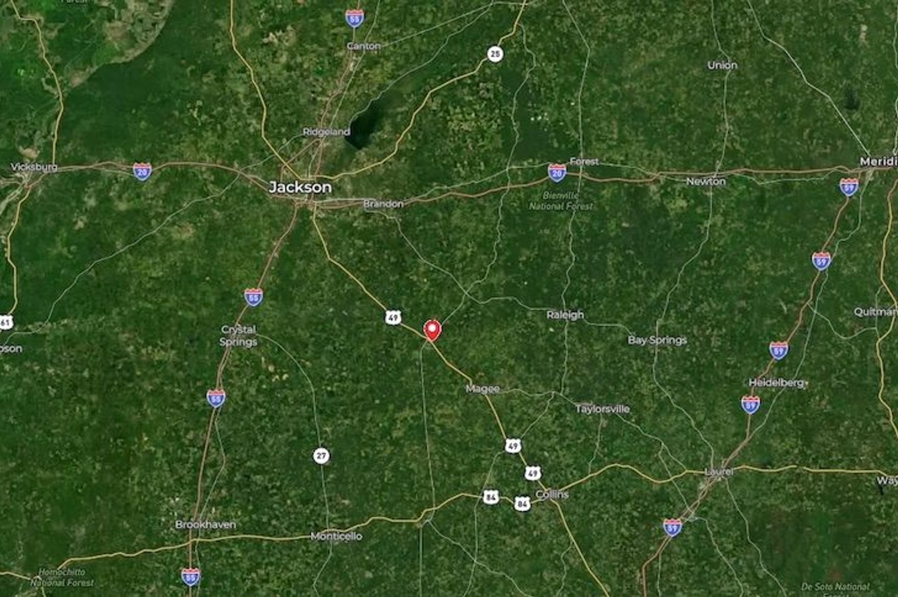
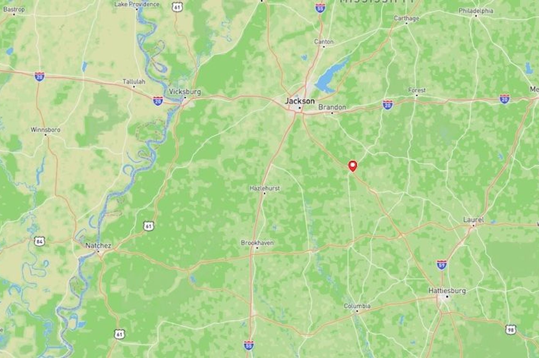
The property is near Mendenhall in Simpson County, Mississippi. The listing places it about 3.2 km / 2 miles from Mendenhall, 45.1 km / 28 miles from Brandon, and 51.5 km / 32 miles from Jackson. That gives the tract a useful rural-small-town base without pushing it into an impractically remote category.
Access and Roads
The listing claims a gated entry directly off Highway 13, an established gravel entrance road, and internal roads/trails throughout the property. That is a strong practical advantage for equipment access, emergency access, trail maintenance, food-plot work, and staged cabin development.
Distance to Services
- Mendenhall: approximately 3.2 km / 2 miles
- Brandon: approximately 45.1 km / 28 miles
- Jackson: approximately 51.5 km / 32 miles
- Hattiesburg: approximately 96.6 km / 60 miles
- Meridian: approximately 138.4 km / 86 miles
- Gulfport: approximately 209.2 km / 130 miles
- New Orleans, LA: approximately 272.0 km / 169 miles
- Baton Rouge, LA: approximately 289.7 km / 180 miles
Service distances are approximate and listing-based. A buyer should verify actual drive times to grocery, urgent care, hospital, hardware/building supplies, fuel, fire response, and farm/feed supply from the specific gate location.
Land and Terrain
Acreage Usefulness
Ninety-six acres is enough to create meaningful separation between the entrance, interior camp area, timber, food plots, and river corridor. The internal trail system is important because land this size can become difficult to manage if access is limited to the perimeter.
Soil and Growing Potential
The listing confirms food plot areas but does not provide soil data. The property may support gardens, orchard experiments, small livestock paddocks, or a greenhouse near the clearing, but this should be checked against USDA soil data, drainage, shade, and floodplain limits before planning food production.
Water Features
The Strong River frontage is the signature feature. It adds recreation, wildlife movement, cooling effect, and long-term land appeal. It should not be treated as confirmed domestic water without checking water rights, treatment requirements, access slope, flood maps, and county health rules.
Utilities and Infrastructure
Power
The listing does not confirm grid power at the property. Highway frontage improves the odds of nearby service, but a buyer should get a written utility extension estimate and compare that against a solar-plus-battery approach for a cabin or camp.
Water
No well or public water connection is confirmed in the listing. The river is a resilience asset, but domestic use would require legal, filtration, treatment, and flood-safety review. A well quote and local groundwater check are essential.
Septic and Waste
No septic system or perc test is listed. Any cabin, home, bathhouse, or long-term camp plan should start with county septic/perc feasibility and setback review, especially near river or wetland areas.
Internet and Communications
The property’s location near Mendenhall, Highway 13, and Highway 49 improves practical communications prospects, but carrier signal, broadband availability, and Starlink sky view should be tested on site. A simple field test at the clearing and river-access areas would be more reliable than map assumptions.
Off-Grid and Resilience Potential
Solar Suitability
Mixed timber can limit solar unless the existing clearing or road corridor has clean southern exposure. Ground-mount solar may be possible near the camp/homesite clearing if tree shading, theft risk, and floodplain placement are addressed.
Heating and Cooling
Mississippi favors cooling-load planning more than winter heating. A resilient build should emphasize shade, ventilation, screened outdoor space, high-efficiency mini-split cooling, backup power, and storm-safe roofing.
Food Production Potential
The food plots and cleared areas show that some land has already been opened and managed. That is useful for gardens, orchard trials, chickens, or small livestock, but river-bottom moisture, deer pressure, soil fertility, and fencing needs must be checked.
Security and Privacy
The gated entrance and interior trail network create a manageable access pattern. Privacy should be strongest deeper inside the tract and along timbered sections, not necessarily at the Highway 13 entrance.
Legal, Zoning, and Buildability
Zoning
Zoning and land-use rules are not confirmed in the listing. Simpson County should be contacted before assuming residential use, cabins, RV use, multiple structures, short-term rental use, or agricultural exemptions are allowed.
Permits and Restrictions
Key items to verify include survey, legal access, floodplain, wetlands, riparian setbacks, septic setbacks, driveway/culvert permits, timber rights, mineral rights, hunting lease status, easements, and any road or utility rights-of-way.
Risk Assessment
Environmental Risks
The river frontage creates both value and risk. FEMA flood mapping, on-site high-water evidence, erosion history, and buildable upland locations should be reviewed before choosing a cabin, campsite, well, septic, or solar location.
Financial / Practical Cost Risks
Development cost risk is mostly tied to utilities, water, septic, driveway/trail maintenance, clearing, flood-safe site work, and insurance. The land is not presented as turnkey infrastructure.
Practical Risks
The property appears accessible and manageable, but it still needs boots-on-ground review for road condition after rain, riverbank access, low wet areas, neighbor visibility, trash/dumping risk, and cell signal.
Estimated Development Path
Phase 1: Due Diligence
Confirm zoning, survey, legal access, FEMA floodplain, wetlands, river setbacks, septic/perc feasibility, well options, utility extension cost, broadband/cell signal, taxes, insurance, and whether any hunting or timber agreements exist.
Phase 2: Basic Use
Secure the gate, inspect roads/trails, identify the highest dry buildable clearing, test cell/Starlink options, get well/septic quotes, map food plots, and establish a simple camp/storage setup only where legal.
Phase 3: Resilient Buildout
If due diligence checks out, a staged build could include a modest cabin, solar plus battery, backup generator, rainwater catchment where legal, screened outdoor work area, garden/orchard test plots, trail maintenance, and a communications plan.
Property Scorecard
Approximately 1.6 km / 1 mile of Strong River frontage is the major resilience asset; domestic water, floodplain limits, and any well option still need county and on-site verification.
The tract sits directly off Highway 13 with a gated entrance, so access is practical but not fully hidden; interior timber and the river corridor should create useful screening away from the road.
Several food plot areas and mixed hardwood/pine habitat suggest garden or small livestock potential in cleared pockets, but soil quality, floodplain boundaries, and water access for irrigation need verification.
Existing gated access, a gravel entrance road, and internal trails reduce first-step development work, but the listing does not confirm grid power, well, septic, buildings, or existing utilities.
The acreage, timber, river frontage, and private camp/homesite clearing support a low-dependency cabin or retreat concept, provided zoning, septic, legal water use, and flood constraints check out.
Proximity to Mendenhall and Highway 49 improves the odds of cellular and service access, but broadband, carrier signal, and Starlink visibility should be tested from the actual clearing.
Internal roads, timber cover, limited controlled entry, and the river boundary create good privacy and access management without making the property too remote for emergency response.
Mississippi’s long growing season is useful for homestead systems, but heat, humidity, storms, river flooding, and insurance constraints require careful site planning.
The combination of timber, hunting, food plots, river frontage, and a potential camp/homesite gives the land real self-reliance depth, though domestic utilities are still unproven.
A 96± acre tract with Strong River frontage, internal roads, timber, wildlife, and a practical town-access context creates a strong Resilience Atlas narrative.
The river bend, wooded interior, and private retreat feel are visually and emotionally compelling, while the unverified utility and flood details keep it from being a clean turnkey story.
Direct Highway 13 access and proximity to Mendenhall are strong positives; zoning, survey, floodplain, septic/perc, and any riparian restrictions remain due-diligence items.
82/120 · Conditional Candidate. Strong water, acreage, wildlife, access, and story value; utility, floodplain, zoning, and domestic water details must be verified before treating it as a resilient retreat candidate.
Final Recommendation
🟡 Conditional Candidate
This property deserves deeper due diligence as a river-fronted retreat and resilience-land candidate. The strongest reasons are the Strong River frontage, 96± acre scale, internal access, food plots, timber, wildlife value, and proximity to Mendenhall/Jackson-area services.
The condition is important: it should not be treated as build-ready until floodplain, septic, water, power, zoning, and insurance questions are answered. If those items check out, this could become a strong practical retreat property rather than just a recreational tract.
Rating context: Candidate levels reflect how well the property fits Resilience Atlas criteria after weighing infrastructure, water, access, buildability, communications, risk, and unresolved due diligence.
Questions to Ask Before Moving Forward
- Is the full legal boundary surveyed and clearly marked?
- How much of the tract is in FEMA floodplain or wetland areas?
- Where is the highest practical build/camp site outside flood risk?
- Is residential or cabin use allowed under county rules?
- Has a perc test been completed near the likely build site?
- What would a well cost, and what is typical groundwater depth nearby?
- Is grid power at or near Highway 13, and what would extension cost?
- What cellular carriers work at the gate, clearing, and river corridor?
- Are there easements, timber rights, mineral rights, or hunting leases?
- What insurance constraints apply because of the river frontage?
Listing claims are treated as unverified leads until confirmed through county, utility, floodplain, soil, communications, and on-site due diligence.